Reinebringen, Å, Henningsvær and more from Norway’s north
The Lofoten Islands is a group of islands in the north of Norway, providing gorgeous views, the opportunity for outdoor activities, and boundless moments of serenity. It takes about five or six hours to drive from one end of the archipelago to the other, so you can see a lot of the islands in just a week’s time. I’ve already written about the incredible Offersøykammen hike that we did in the islands, but there were some other spots we looked at during our visit.
We had originally wanted to do a road trip from Ålesund all the way up to the Lofoten Islands. I had done a bunch of research and mapped out some places to stop by and have a look, but due to time constraints, we decided to skip the road trip and fly instead. It would be quicker and allow us enough time to explore Lofoten. It was a long journey from Ålesund. We had to leave early in the morning, around 5:00am, to get one flight to Oslo, and then another from Oslo to Bødo—from which we would pick up a rental car and board the ferry to Moskenes (in the Lofoten Islands) with the car. Depending on your itinerary and where you are travelling from, you can also avoid ferries and take the “long way” and drive east in a giant backwards C-shape and then reach the Lofoten Islands, but I’m not too sure what there is to see around there, or why you would want to avoid the ferry. 😝
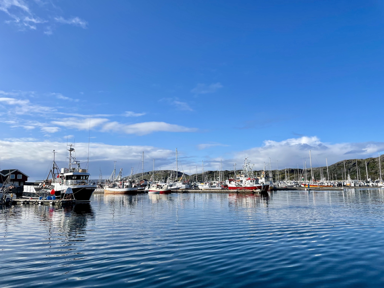
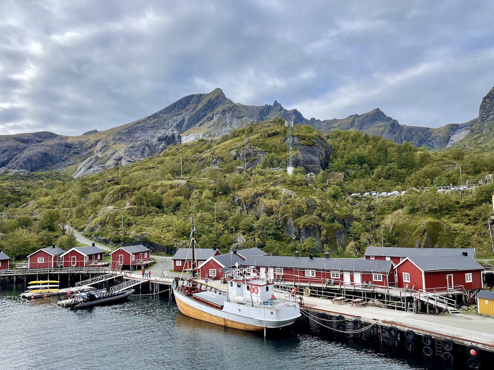
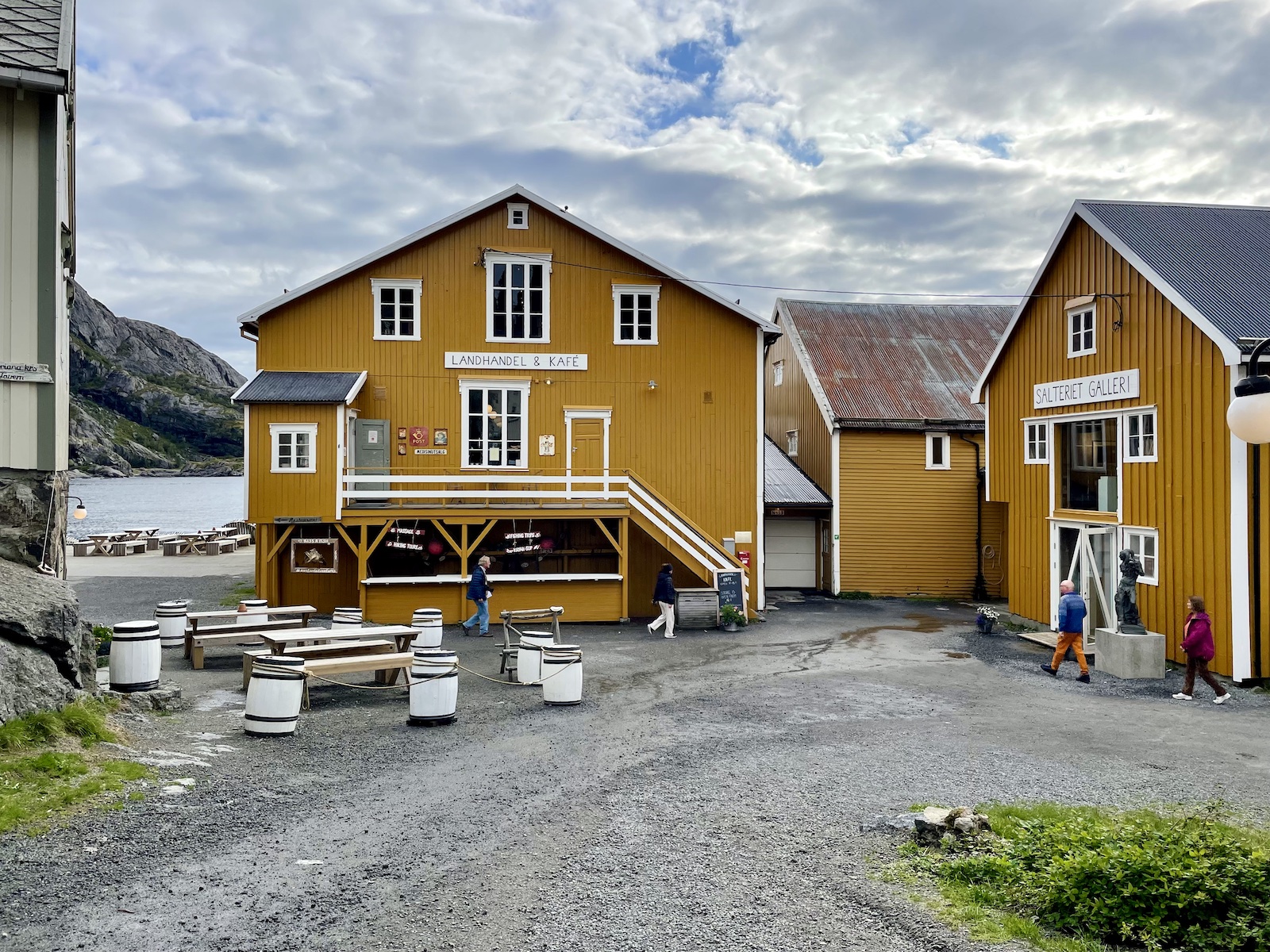
It was a whole day of travel but we got through it. We spent two nights in Reine, one in Leknes, and two in Svolvær. These three towns are among the bigger towns in Lofoten, but it’s still worth mentioning that the population is not that large to begin with, and the area is still rather remote and has a quiet-town feel all the way through. If you’re a city dweller, or a city person, you can certainly understand what I mean. Svolvær looked pretty substantial on the map, but it’s still a fairly quiet town. If you are looking for a unique experience, you can stay in a rorbu—a traditional fishermen’s cabin. There are some that are renovated in a semi-luxurious fashion, while others provide mostly basic accommodation.
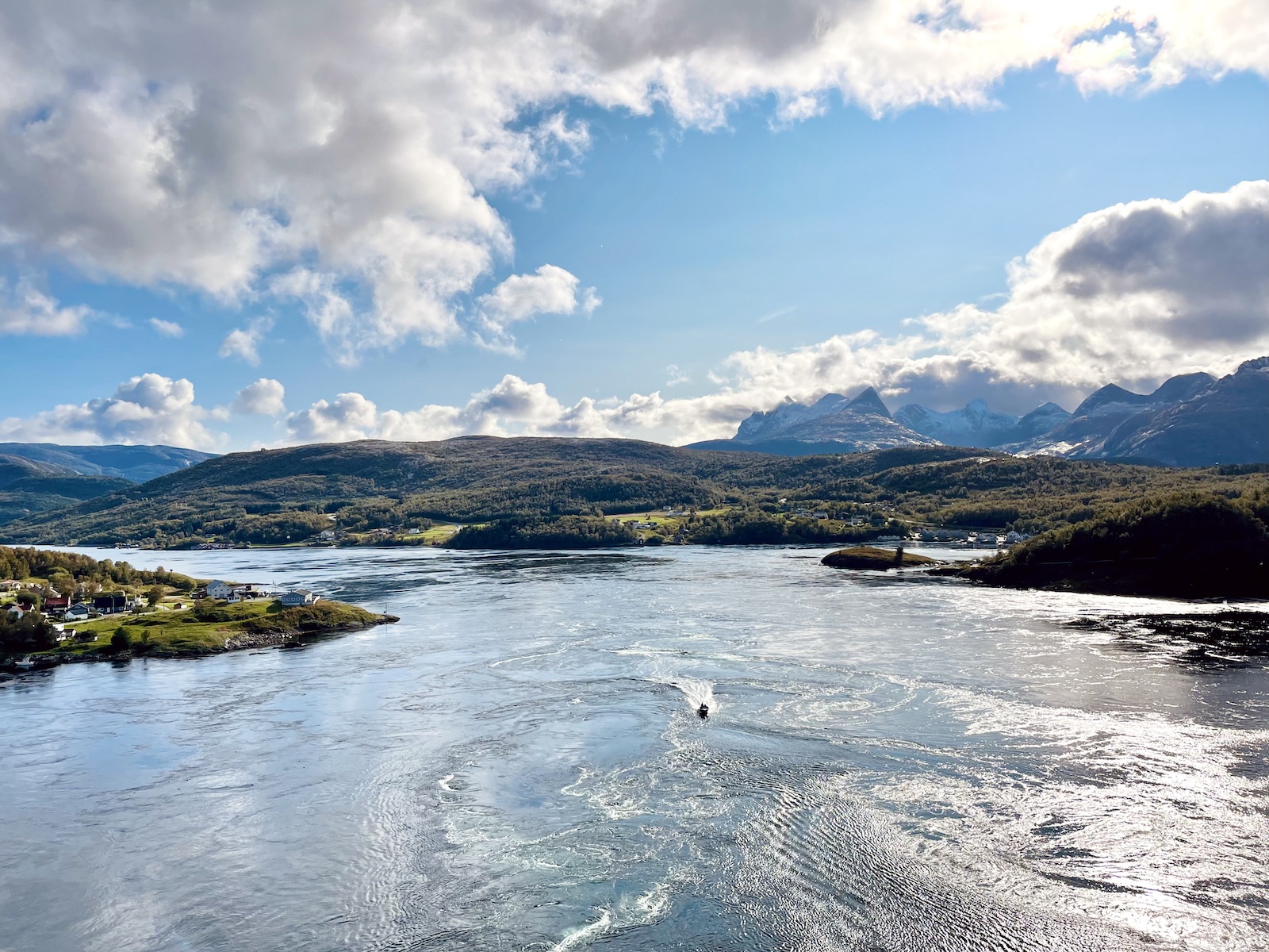
We had several hours between disembarking our flight and then boarding the ferry from Bødo to Moskenes with the rental car. We had enough time to explore the town and sit in a library cafe, as well as look at Saltstraumen, a small strait where the water currents going opposing directions meet and cause a whirlpool-like phenomenon. The currents are extremely fast, but looking at it from the bridge over the strait, they seemed to move so slow. Even with the relative position and speed of some boats in the current, it still seemed like I was watching something in slow-motion.

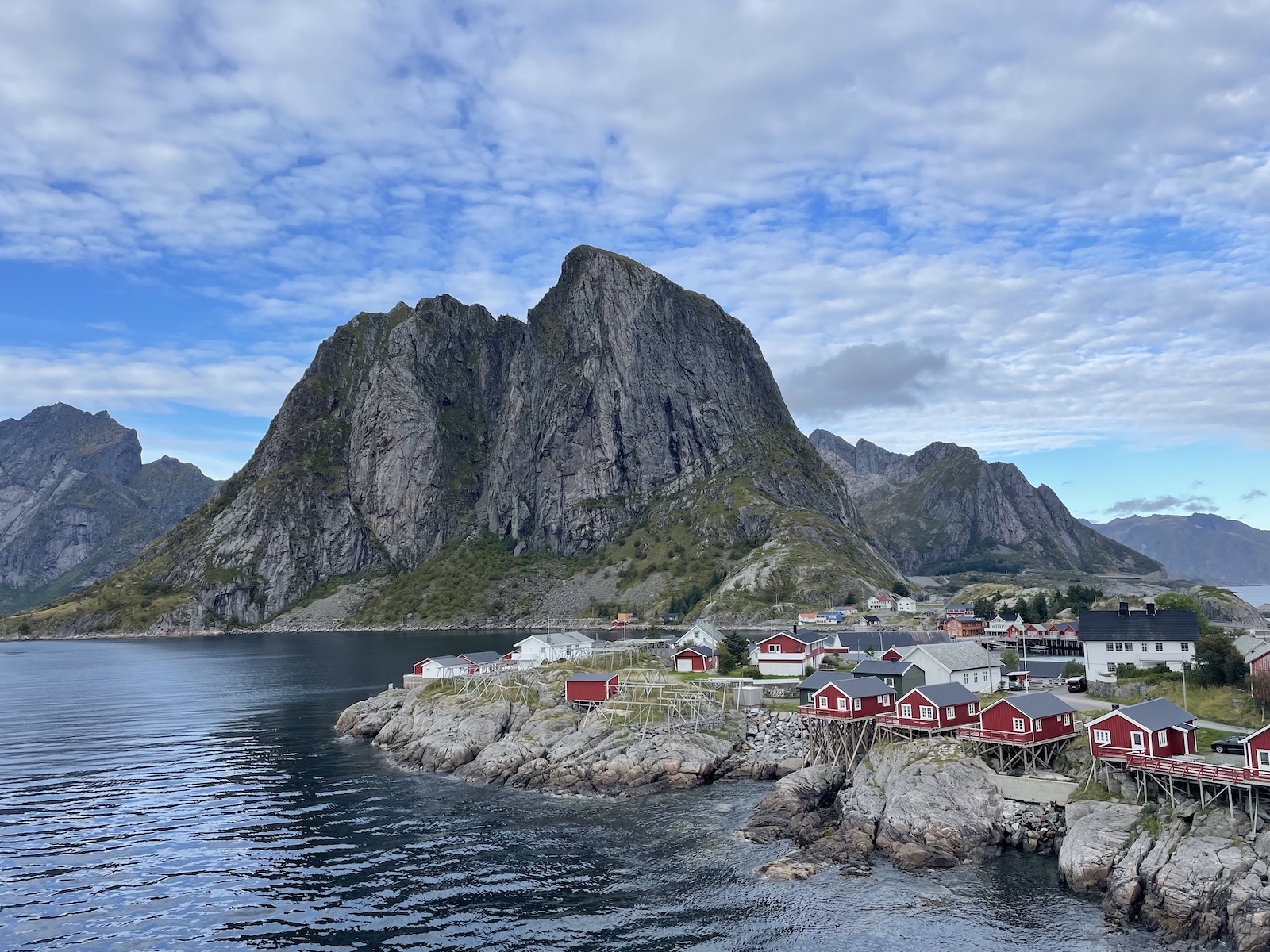
Our two nights in Reine were in a renovated manor house, which had a fancy bathroom that I felt was out of this world. I don’t know exactly what it was about it, but it was extremely spacious and comfortable and there was a beautiful view through the window. Our first night was really just settling in after driving to the house from Moskenes after arriving on the ferry. There was quite a bit of traffic when coming onto the island because it was a single lane road in many parts, with people having to give way to one another in their vehicles. It must’ve been about 9:00pm when we arrived.
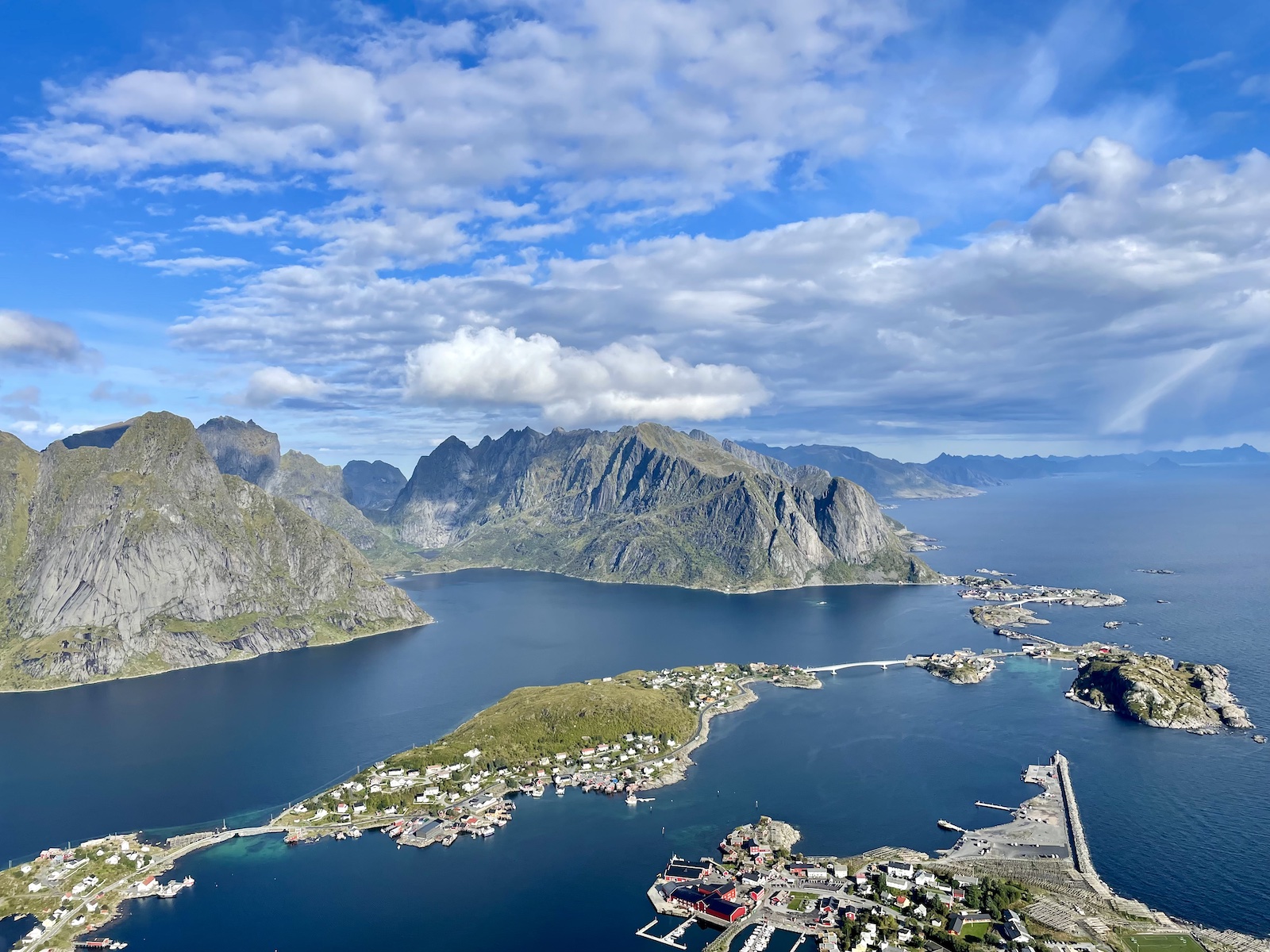
Our first full day in Reine was dedicated to doing the Reinebringen hike, which I mentioned in my last travel post and gave it a bit of a diss because there weren’t the “360º views” I feel like so many people had advertised. I will just come right out and say it: it felt like a bit of a cop-out because the hike was all stairs, and I personally find such hikes to be a little underwhelming because I prefer to be on the ground and battling natural terrain. In Norway, Nepalese sherpas were hired to lay down a lot of the stones that make the pathways on hiking routes more safe. I do understand the value of the paths and they do make the hikes more accessible for some people—especially for popular hikes like the Reinebringen. But considering we’d done the Sealy Tarns track in New Zealand with about 2,200 steps, Reinebringen felt somewhat similar in difficulty and terrain, just with different views.


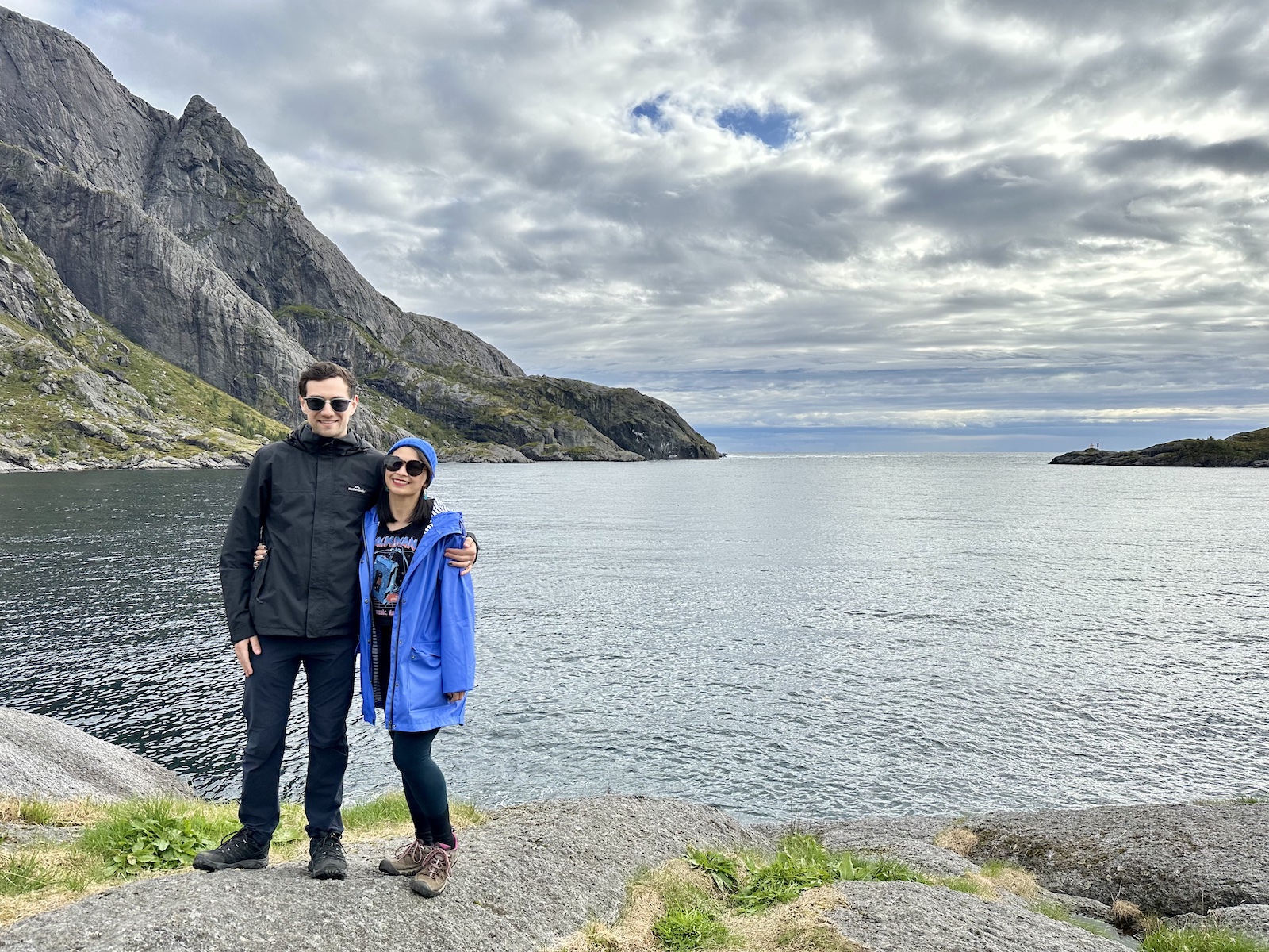
If you’re an experienced hiker you’d also know that steps feel far more difficult than climbing a mountain. We had started the hike somewhat early after getting something to eat, but at the top of the hike, it was quite busy with people sitting and picnicking. I think there were some areas where I could get a better view, but it was a bit muddy, or there were too many people hanging around taking photos or sitting and eating, so it felt too dangerous to venture too far. We found a spot that was somewhat shaded by part of the top ridge that was higher still, and took our photos and headed back.

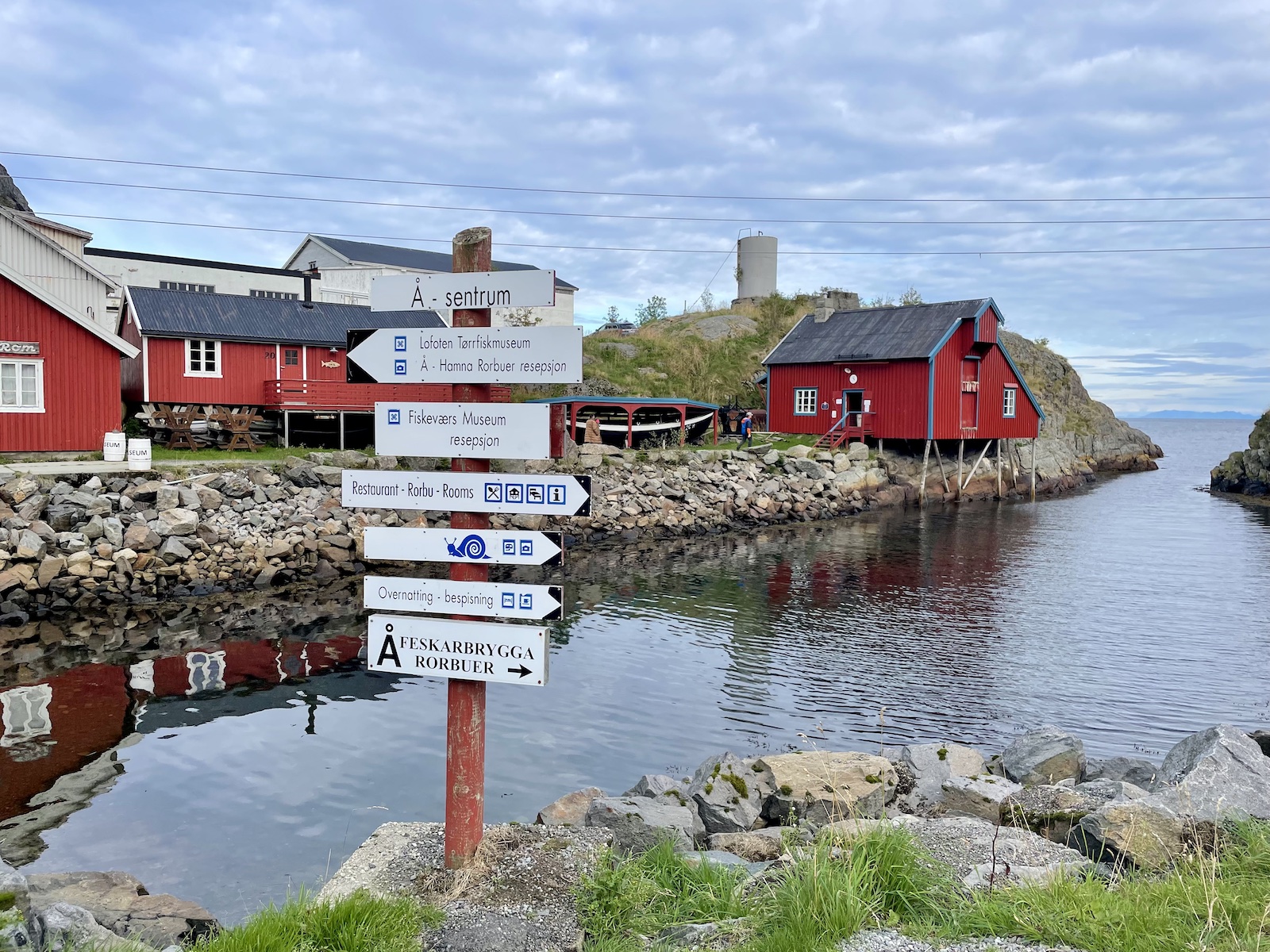
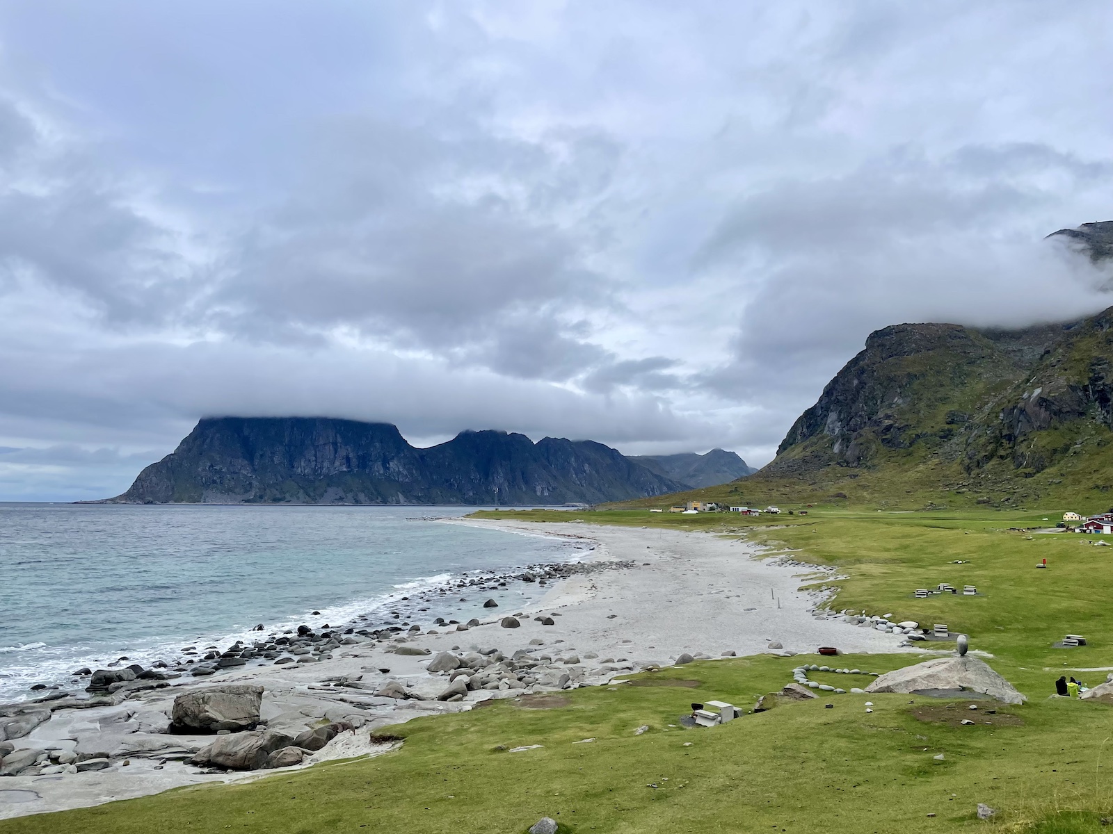
We took some time to visit the town of Å, a well-preserved fishing village, which is at end of the Lofoten road (highway E10). Å is also the last letter of the Norwegian alphabet. I say the end, even though it is to the south-west of Reine. We chose to go west to east in Lofoten, but others go east to west, so would end their Lofoten journey with Å. It doesn’t really matter! After a short tunnel and a carpark… that really is the end of the highway, though. 🥲
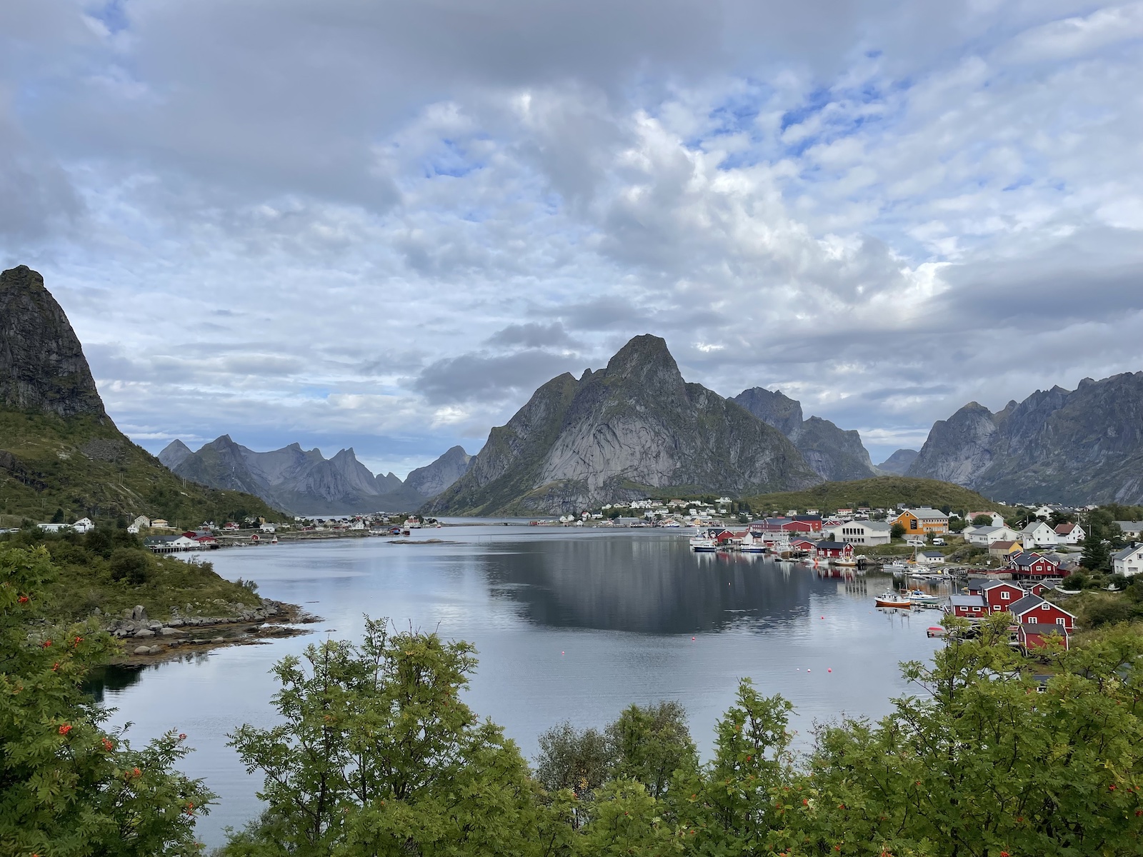
Not too far from Reine, heading east, there is a popular photo spot on the Hamnøy bridge. Normally, popular photo spots are overrun with tourists, but we caught this spot in the evening so there were only a few other people. We had to park our car in a spot on the east side of the bridge then walk up. Everyone will have taken this photo, but I have to admit that there is nothing quite like taking the photo yourself and seeing the spot in real life. ✨
The following morning started the drive to Leknes, a town about the same size as Reine, and only an hour east. When we checked out of our guesthouse at Reine, the host suggested we check out Nusfjord as it was a pretty fishing village on the way. We had the time so we dropped by. We didn’t do any activities but we went for a wander and enjoyed the views, and then looked in a local art gallery.

I had wanted to do a hike near Haukland Beach, or a hike up a mountain called Mannen, but we were quite tired and didn’t want to burn ourselves out from hikes, so skipped it and just walked around the area without doing any hikes. After all, the following day we did the incredible Offersøykammen hike that I already blogged about—I wanted to save all my energy and drive for that one. 😍


After staying the night in Leknes, and doing the Offersøykammen hike, we headed to Svolvær, where we would spend our last couple of nights in the Lofoten Islands. We drove a little bit south on our way to Svolvær and visited the town of Henningsvær. It was quite tricky finding a place to park since the roads were so narrow and there were so many tourists. The popular attraction to see in Henningsvær is the Fotballbanen, a football pitch in a stunning setting by the water. Aerial shots are a lot more awe inspiring than seeing it in person on land, but there is still something quaint and surreal about it.

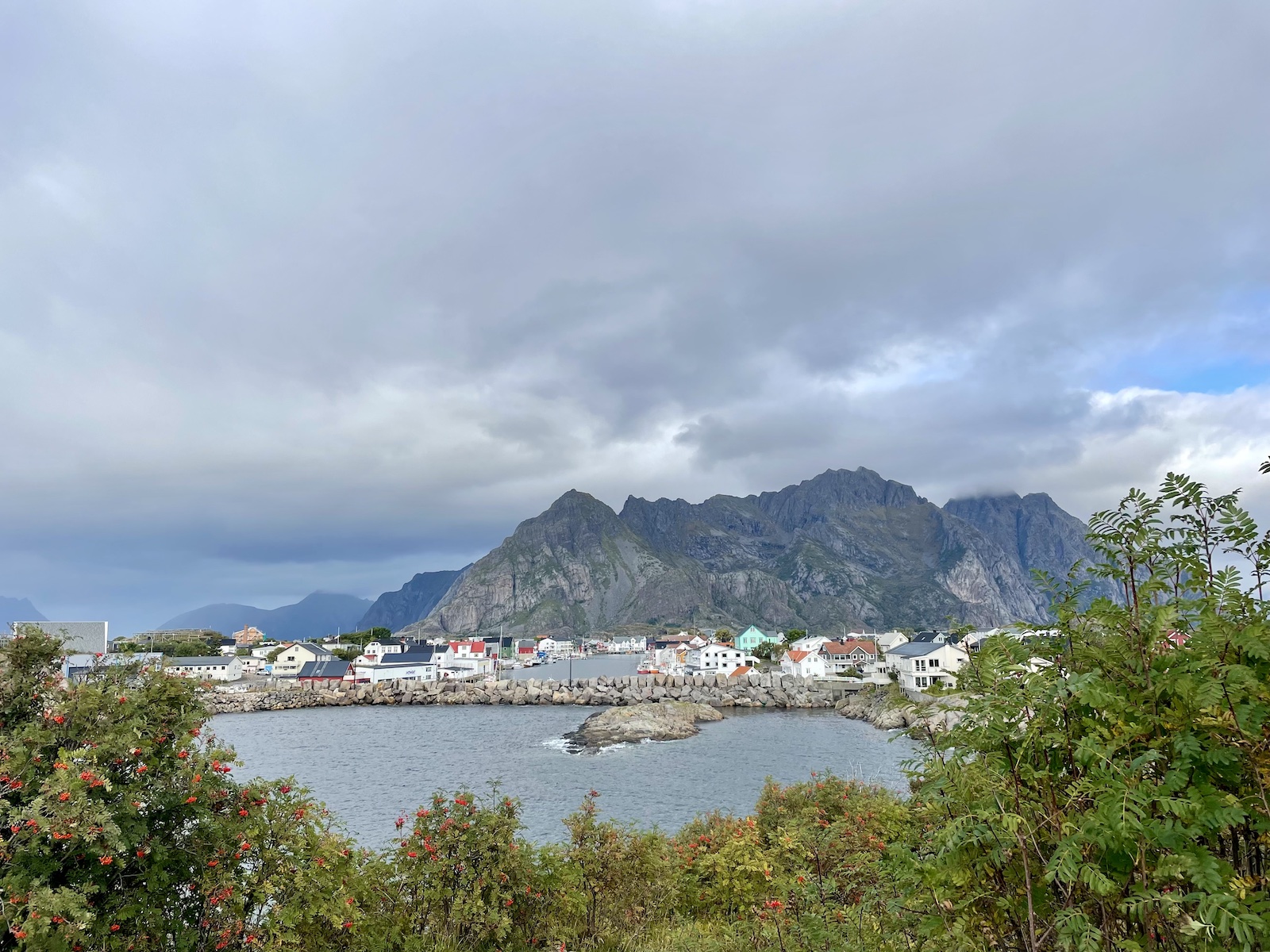
There are some hikes to do in and out of Svolvær, but we wanted to spend more time relaxing and just walking around town. Although Nick and I like the peacefulness of small towns and love it for a getaway, we were starting to tire of the small towns by the end of our time in Svolvær. 🥲 The Lofoten islands were very quiet and we do enjoy going out and seeing cities at night, so the fact that there was nothing much to do in a small town meant that we were looking forward to the next part of our trip (Singapore) and going home soon. There were some pretty scenes Svolvær had to offer and we had dinner at a nice restaurant. We thought we could catch the tiniest glimpse of the Northern Lights (there was something like a 4% chance of seeing it that night) but couldn’t see it really.
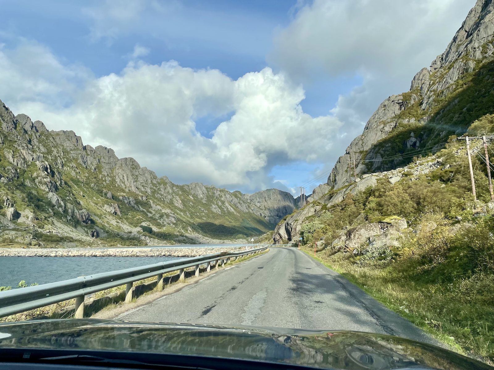
After two nights in Svolvær, we drove to Evenes airport, which was about two-and-a-half hours east. Going east was really the only way “out” of the Lofoten Islands on that side. There wasn’t a great many points of interest to see on the way, so we only really stopped for restroom breaks. Evenes is a small airport—from there we were heading back to Copenhagen via Oslo, and then heading home with a stopover in Singapore for a couple of nights.


Other posts about this Scandinavian trip:
- 3 days in Copenhagen’s city centre and its neighbourhoods
- Visiting LEGOLAND and LEGO House in Billund
- Stockholm: Fika, food, and metro station art
- Speedrun through Gothenburg
- Oslo and appreciating the work of Edvard Munch
- From Flåm to Bergen via the scenic route, and car rental chaos
- Trollstigen and the drive to Åndalsnes
- Hiking the Rampestreken viewpoint and Litlefjellet in Åndalsnes
- The little town of Ålesund
- A new favourite hike: Offersøykammen in Lofoten Islands, Norway
We have travelled to Europe several times and used Singapore as a stopover, always on the way back. It feels like a nice way to settle back into a timezone close to home, but I have to say, when it comes to writing about travel for my blog, I get exhausted and tend to skip Singapore. 😂 Let’s see if I do that this time or not… 😆