A new favourite hike: Offersøykammen in Lofoten Islands, Norway
The Offersøykammen hike was a hike we did in the Lofoten Islands in Norway, and it definitely tops my list of favourite hikes. The hike is located in the Vestvågøy municipality, and is a relatively short hike. The closest major town is Leknes, where we stayed for just one night in the middle of our trip in Lofoten.
Offersøykammen is not one of those day-long ordeals—it’s not over four hours, but it’s certainly not as short as an hour. It took us almost two hours as fit, active people, so I’d say it’s a pretty strenuous 2–3 hours depending on how comfortable you are with climbing and descending rocky terrain with a steep gradient. That’s right—it’s quite a climb. The Norwegians are natural-born hikers and it’s worth considering how frequently they hike and how much it’s a part of their life. If they say a hike is easy, definitely see that as a “medium” for a relatively fit or experienced hiker.
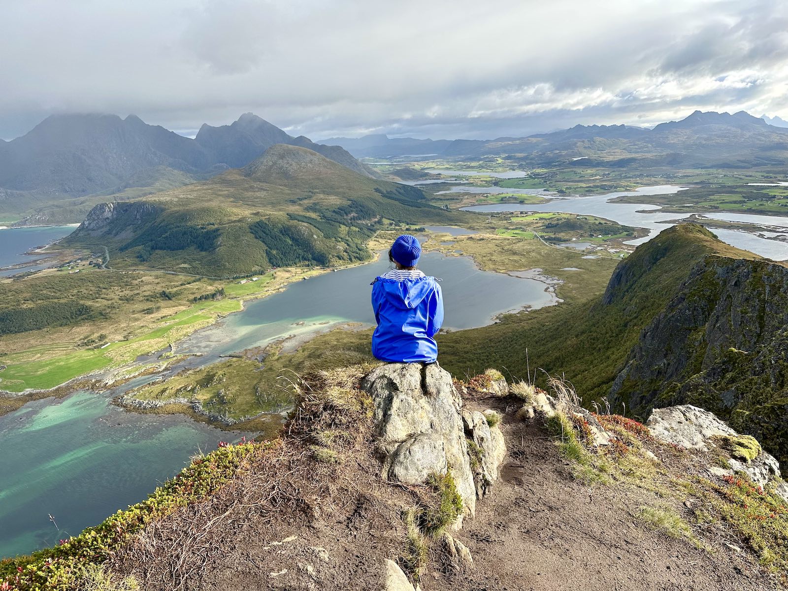
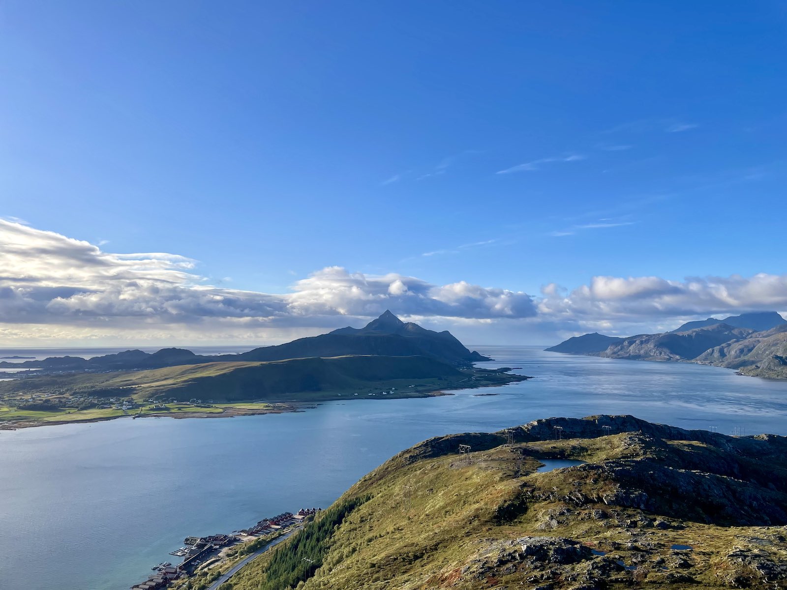
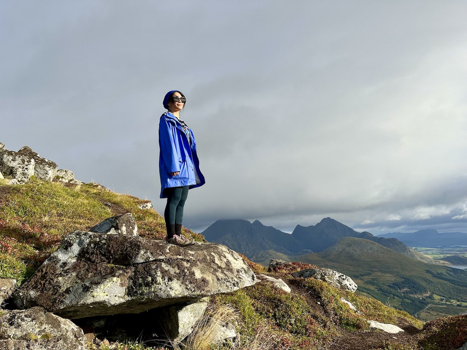
The views from this hike are so incredibly rewarding, especially if you consider the effort-to-reward ratio. For a relatively short hike, the views are incredible. I kept seeing “360 degree views” advertised for multiple hikes in Norway, but this one was truly, 100%, 360 degrees. Views all the way around. We had done the Reinebringen hike (which I’ve not yet written about in a blog post ) in Reine, but even then I didn’t think that was a complete 360º view. There was a part of the ridge that was too dangerous to climb further, so some of the view was off the side of the ridge.
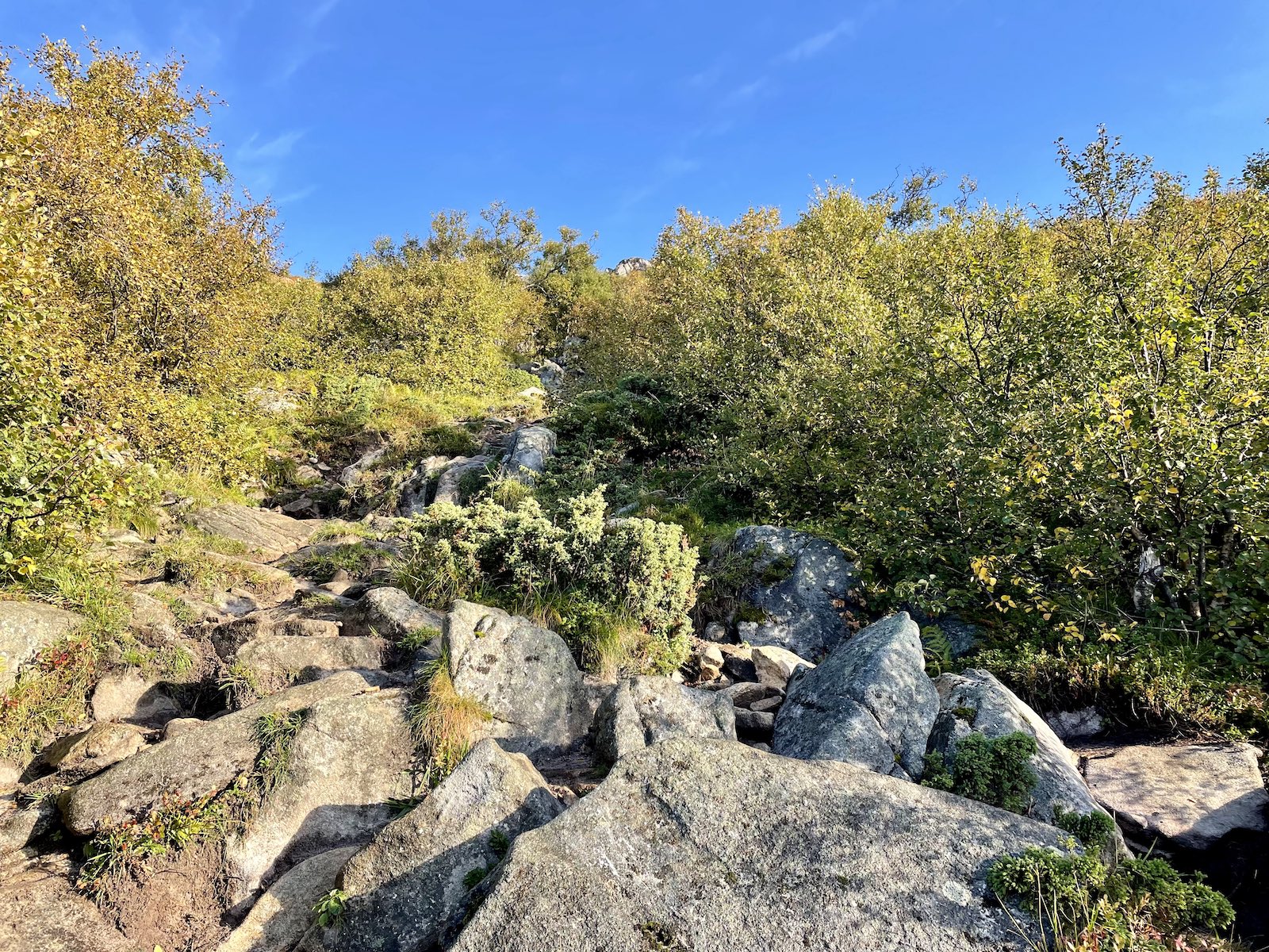
What makes this hike difficult is the terrain and the steep grade. I’m not joking when I say that half the hike, you are looking up or looking at the side of a mountain, unable to really gauge where the top of it is. The bottom half is filled with trees and not very open, so you’re scrambling amongst bush for a while. When it gets to being open at the second half of the hike, you experience trying to crane your neck to see the top of the mountain. It seems like it never ends and the angle at which you’re hiking makes it quite deceiving.
The start of this hike is actually on the E10 highway. There is a concrete parking area nearby called Skreda. There are toilets and you can also fill your bottle here. Then you need to cross the highway to locate the start of the trail, about 600 metres to the east. The original start of the hike is just opposite the point at which you can see three cabins by the water.
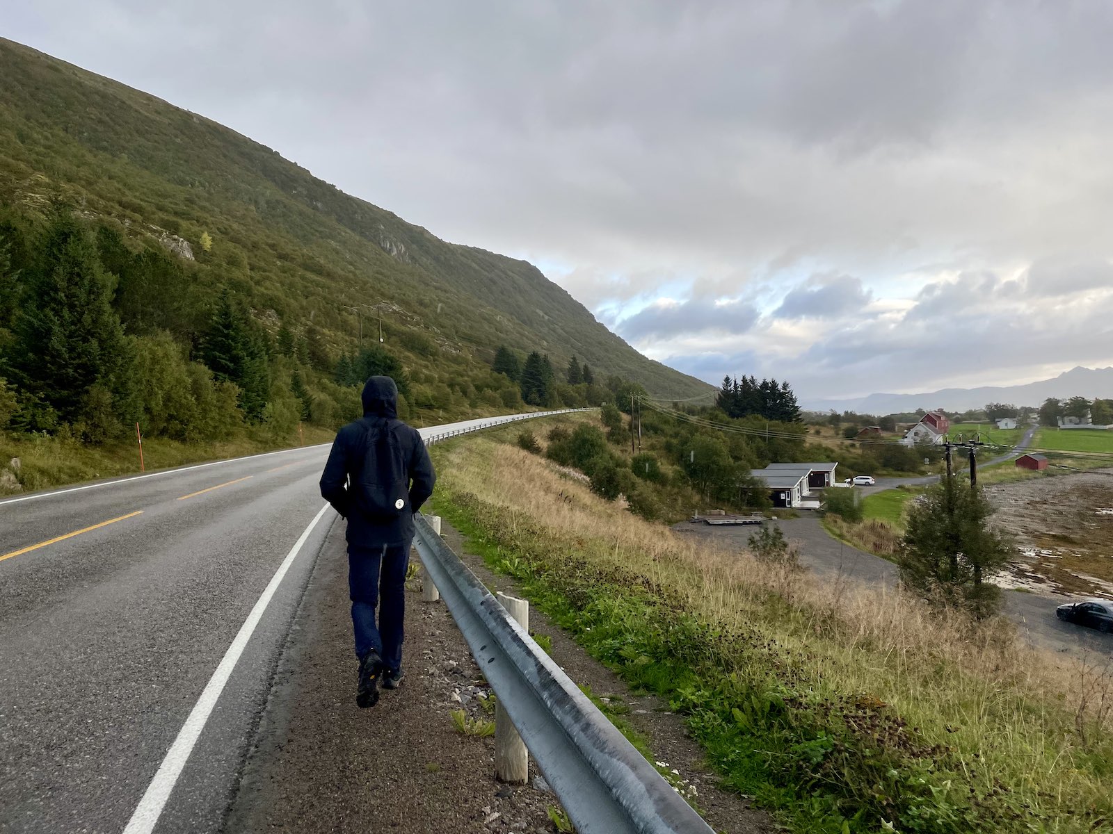
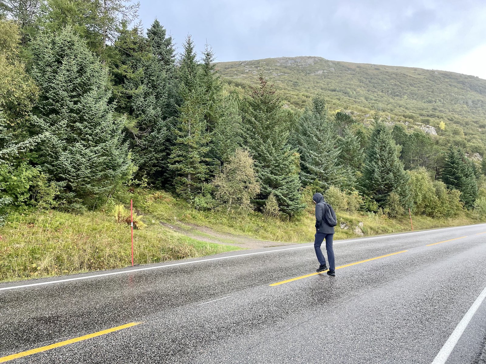
Apparently there are a couple of ways that all lead to the same point. One of them is closer to the parking than the original start. Any path leading upwards will likely be leading you towards the hike, but it can help to check the satellite view on your maps app or Google maps based on your current location just to be sure. We learned the hard way that one of those paths was actually more difficult.
It was scrambly, wet, and slippery due to the recent rain. I think a tree had even fallen over the path and maybe had fallen just the night before. In better weather it might have eventually led us up the mountain without struggle. We turned back and walked along the highway a bit further and found the original trailhead.
There was a lot of climbing up rocks to begin with, and then we began to see a bit of a view behind us, through some sparse trees. It was still rather early in the morning so we weren’t getting a lot of sun yet. Due to the recent rain, we had a lot of clouds in our view.
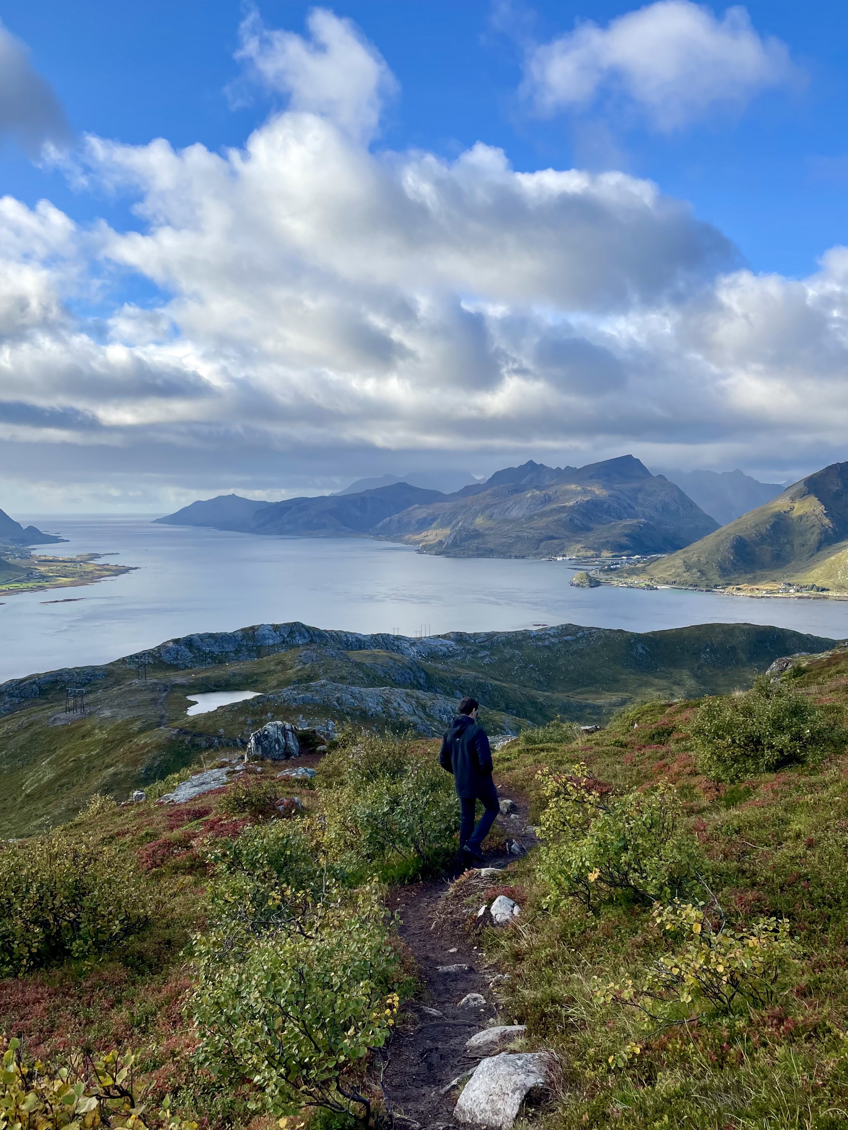
After a few hundred metres of elevation we found ourselves above the trees so we had a better view of the water below. At this point it also looked more like we were climbing a mountain as there were less trees, and less visible rocks. The trail split in some areas but became less steep so it was easier to look ahead. You have to keep reminding yourself to look back while doing this hike, as all you’re seeing is the mountainside as you climb.
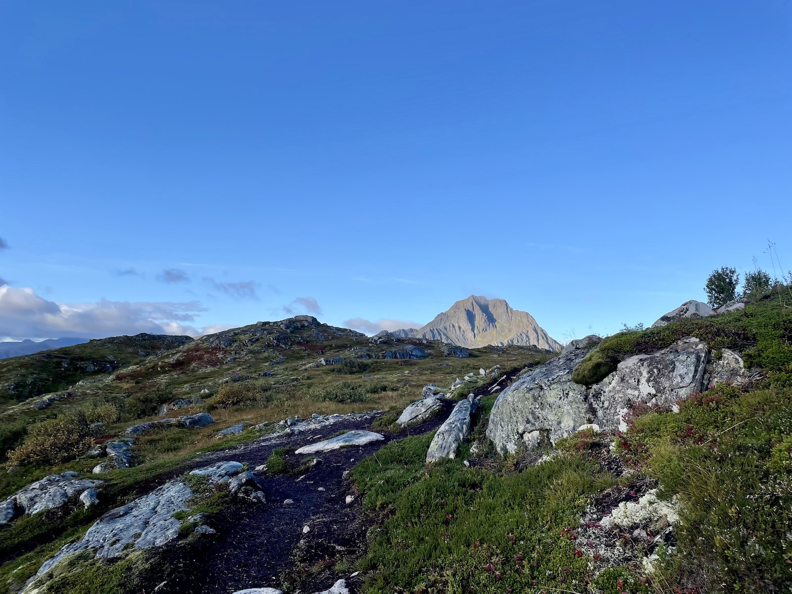
This part can also be a little muddy if there’s been recent rain so you need to watch your step as it might not be that grippy. There are some larger rocks you can get a better footing on, but overall you just keep climbing upwards.

There are tonnes of opportunities to take photos of the beautiful view. Just make sure you keep turning around and having a look.

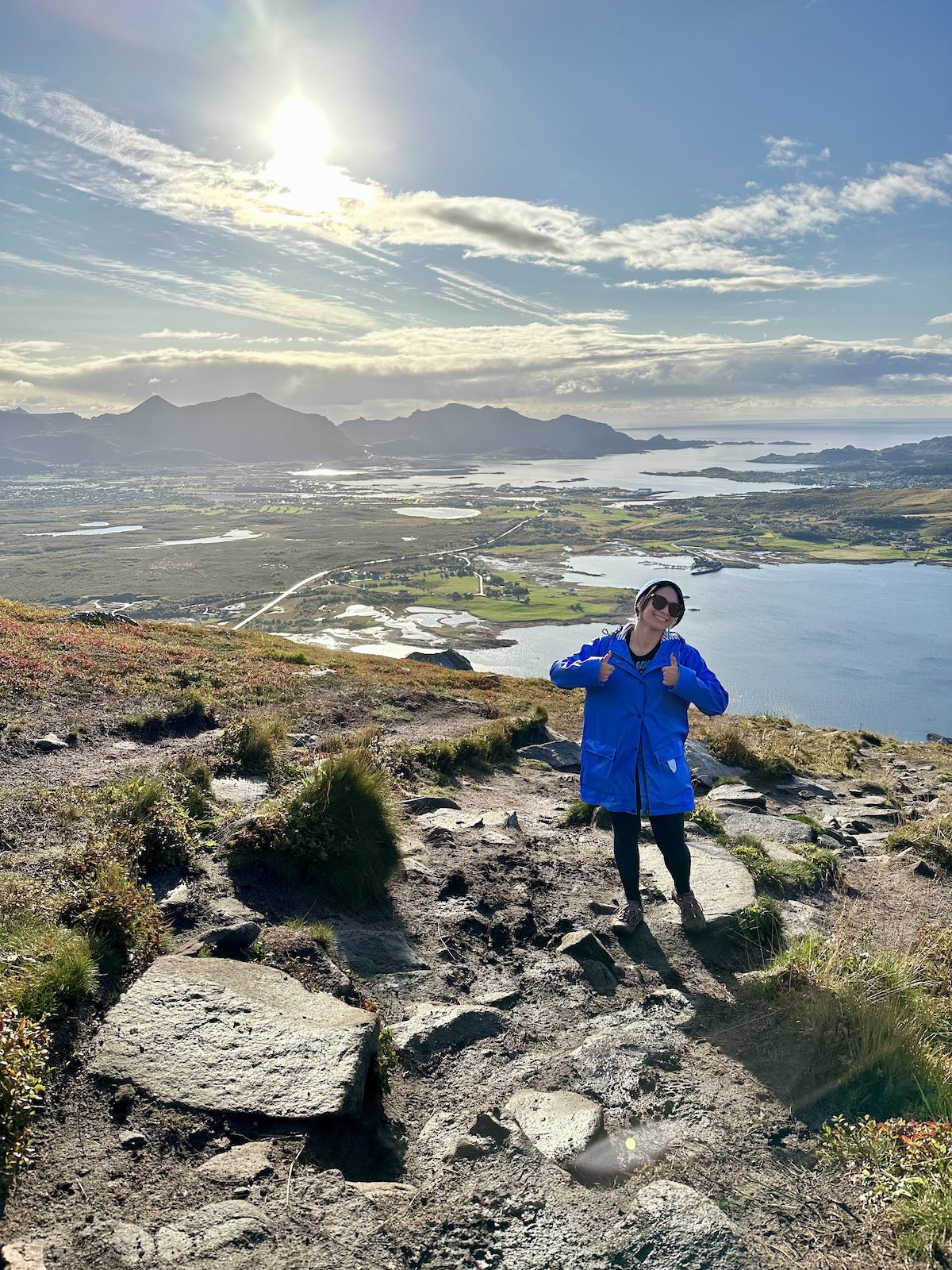
At some point, the illusion of the top of the mountain stops being an illusion and you reach a point where the ground is flat and you can see more of the view.


Continue walking and you’ll notice the metal box with the guestbook. That is, if you’re not taken aback by the view first.
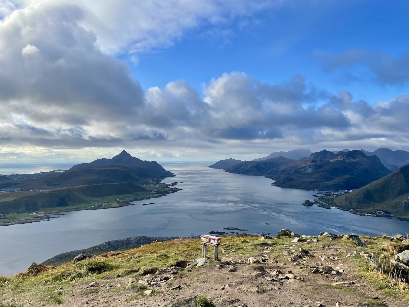
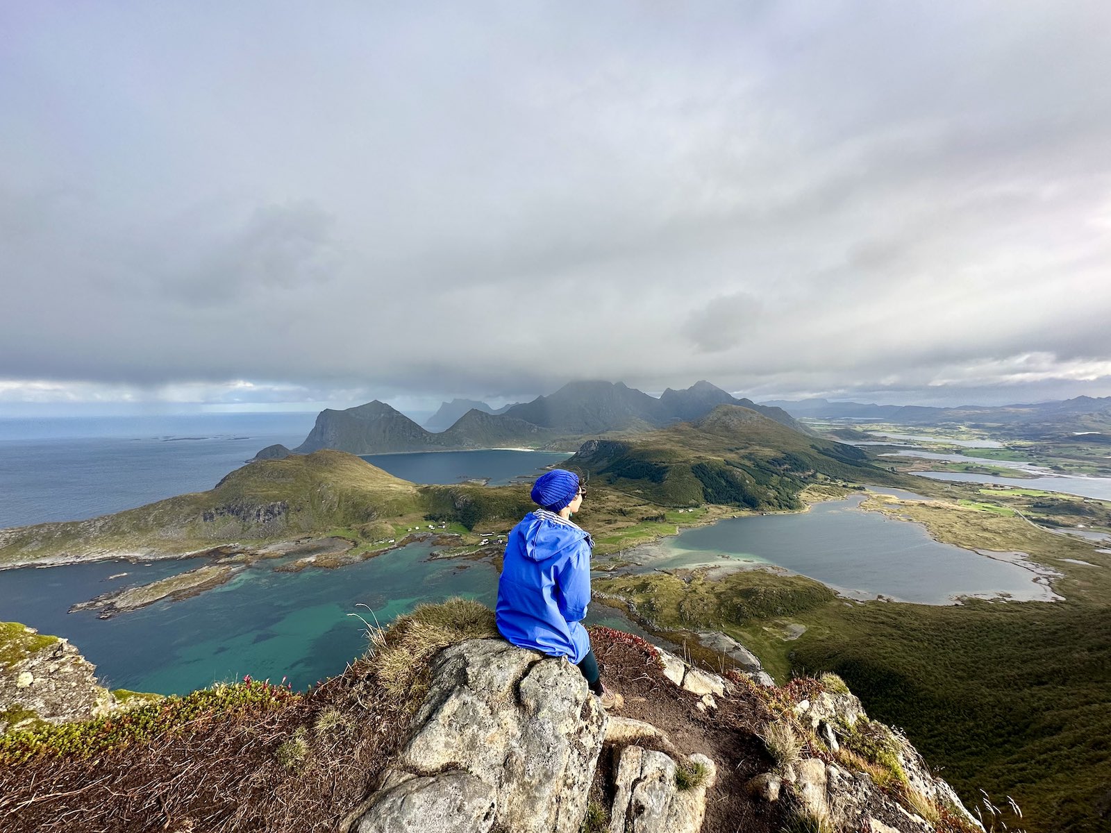
For a brief moment I pondered if there was anywhere else to go from here. Maybe just walk out that way (there’s a ridge, but I don’t think it’s very safe), walk around a little bit and take in all the views, but essentially, we were at the top of the mountain. The start of the hike was a long way down, and in the distance we could see the other islands of Lofoten. We could see the sea stretched beyond our peripheral vision, and the little, sparsely populated islands on it.

We took photos but mostly took in the incredible view. I wanted to laugh at the Reinebringen hike we did a few days prior and say “360 degrees, my ass”, but I know I maybe wasn’t on the topmost part of the mountain, and it was a busy hike… but just in comparison to hiking Offersøykammen and the views it had to offer, this was by far the most incredible view I’d seen. It filled me with every joy that a hike in nature possibly would. My affinity for mountains, and lakes, and natural green, just completely fulfilled.
I sat on a rock and looked out at the view and couldn’t believe it was real. I felt like I was at the edge of the earth (I know—earth has no edge).
The rain began to pick up slightly as we signed the guestbook. We did worry about a potential downpour on the descent. I wished for more moments to take the view in. I was, and am still so determined to go back.

The descent was easier as it wasn’t too technical, but because there wasn’t much grip, it was a little trickier. You could go the route of being super careful or you could—like I’ve seen most people do—just descend in a speedy fashion with broader strides and make sure you are engaging all your leg muscles. That doesn’t quite work for me though, and I think it’s because I have smaller feet. Even though I try to get a grip on rocks and use as much surface area of the sole of my foot to maintain stability, my feet are often so small that I risk slipping on rocks. Compare that to Nick’s larger feet, which allow him to step on and get a grip on some rocks that I would observe and know to be unstable for me and my foot. It’s an interesting observation, I must say.
The rain didn’t actually get any worse on the descent, and it started a little windy but calmed down. It made me wish we really did take another moment to savour the views. In the grand scheme of things, Offersøykammen was a relatively short hike, and although I would do it again in better weather, only time will tell when I find myself visiting this corner of the earth again. It’s really quite far from Australia. 😅
If you find yourself in the Lofoten islands I strongly recommend this hike. Even if you are not extremely fit, it will take you a few hours at most. The views are exceptionally rewarding. If the rain has been really heavy in the days prior, I wouldn’t recommend it since it can be slippery and dangerous, and not very enjoyable. But other than that, definitely give it a shot. 🤩
Other posts about this Scandinavian trip:
- 3 days in Copenhagen’s city centre and its neighbourhoods
- Visiting LEGOLAND and LEGO House in Billund
- Stockholm: Fika, food, and metro station art
- Speedrun through Gothenburg
- Oslo and appreciating the work of Edvard Munch
- From Flåm to Bergen via the scenic route, and car rental chaos
- Trollstigen and the drive to Åndalsnes
- Hiking the Rampestreken viewpoint and Litlefjellet in Åndalsnes
- The little town of Ålesund
Do you think you’ll enjoy this hike as much as I did? Are there other hikes on your list for Norway?