Tasmania west coast: West Coast Wilderness Railway, Henty sand dunes, Queenstown, back to Hobart
This post is the third and last instalment about our Tasmania trip last month. Not just that good things come in threes, but generally, our brain actually does tend to remember things in groups of three. I recently listened to a Time and Attention podcast episode that explored using this knowledge to help increase productivity, and it did remind me that I should really try and finish up this short series of posts. 😊 In the last post I wrote about this trip, I recounted how we visited The Big Tree and were on our way to the west coast.
West Coast Wilderness Railway
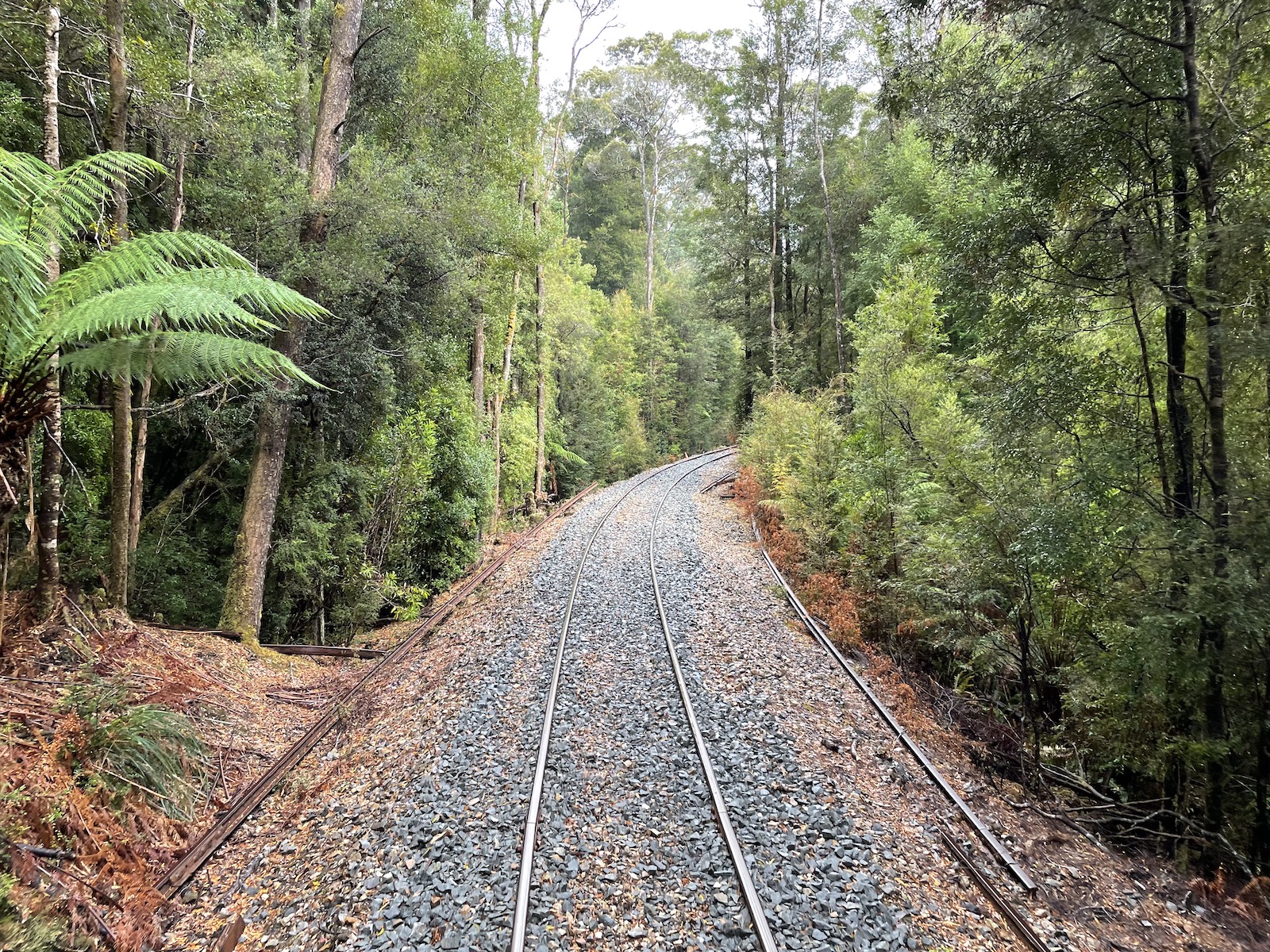
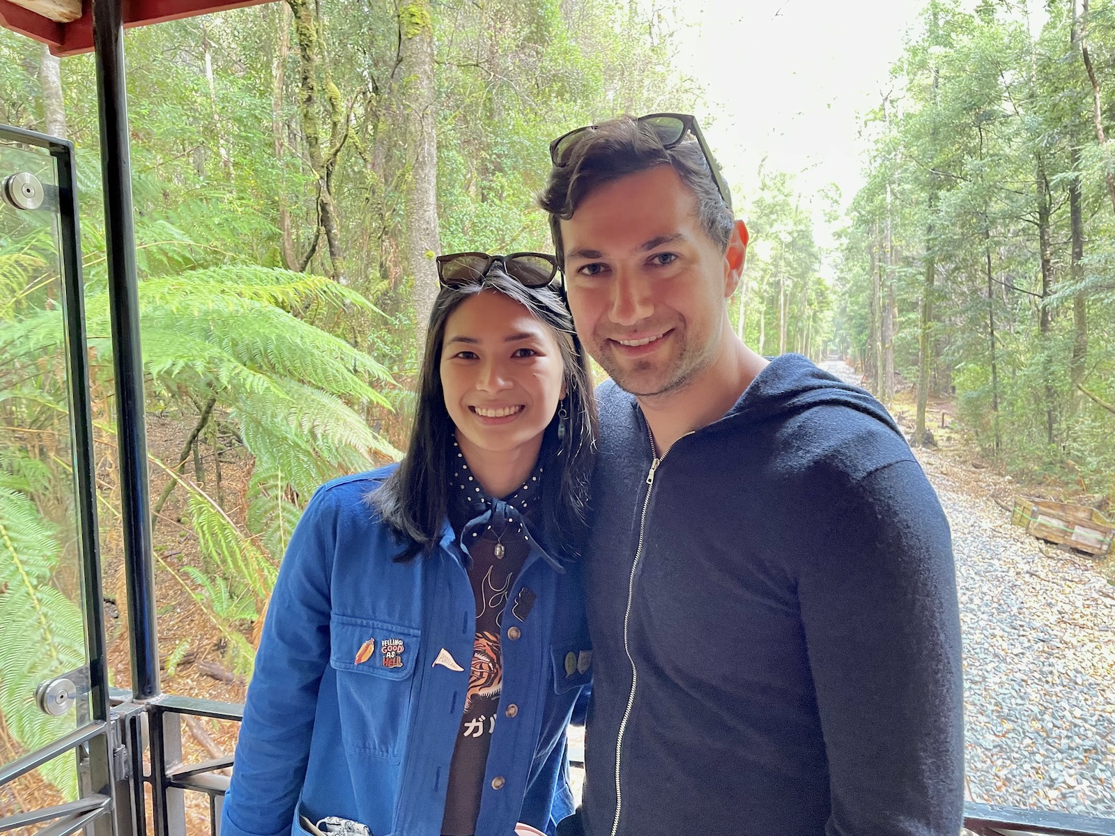
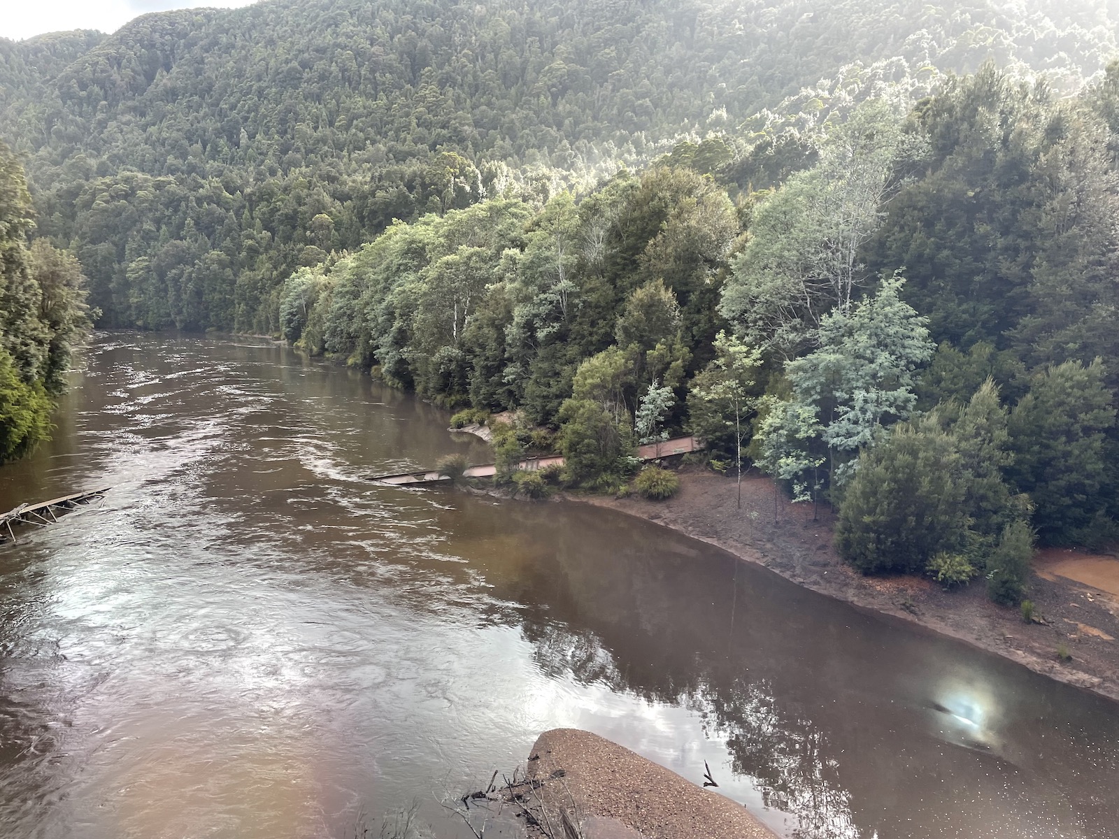
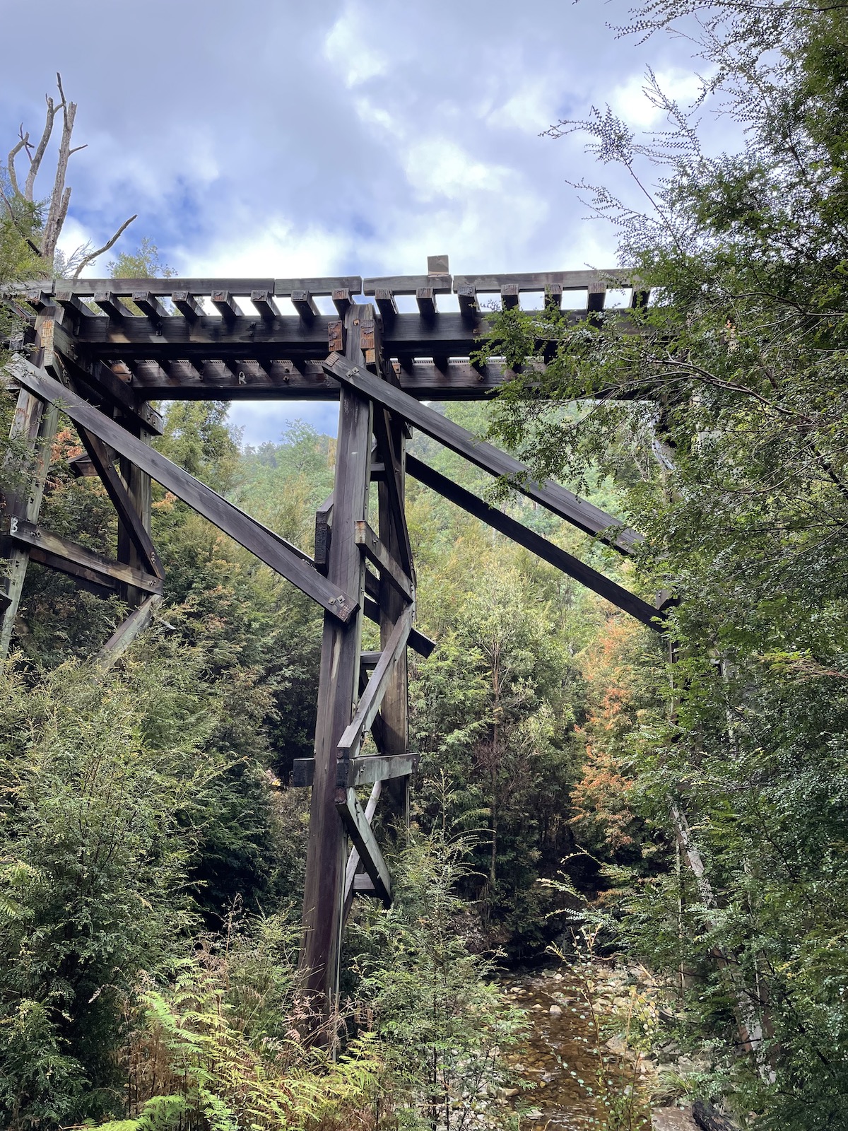
Our trip mainly revolved around one event, which was the West Coast Wilderness Railway. This was something Nick was really keen on, and it sort of determined the direction we were doing our road trip in, and the days we would be away. The railway usually has a full day tour which involves going the full distance between Strahan and Queenstown, and back again, but after Nick contacted them, they said they were only running the half day tours from each town to the centre point (Dubbil Barril) and back. Later, we realised that there was quite a bit of maintenance happening, which is probably why they couldn’t run the tours. We chose to do the tour from Strahan, as the views promised were of lush green rainforest, and it seemed visually more appealing than the tour from Queenstown.
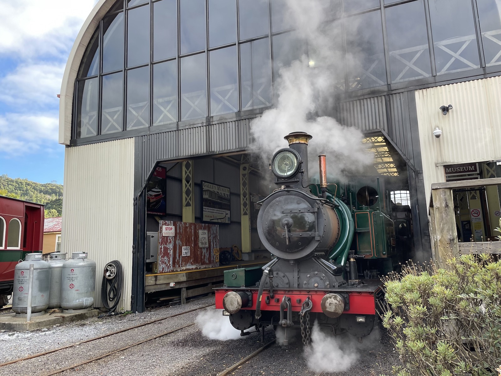
We still stopped by Queenstown on the way back to Hobart and before ending our trip. It looks like the Queenstown half day trip would be more interesting in terms of the history of the railway and knowing more from a technical perspective. Transport aficionados like Nick would probably love it. Because of that, we will likely be back! 🚂 Perhaps what was just a little disappointing about our train ride was that we had a diesel locomotive, not a steam one. So it did inherently seem less impressive. 😆
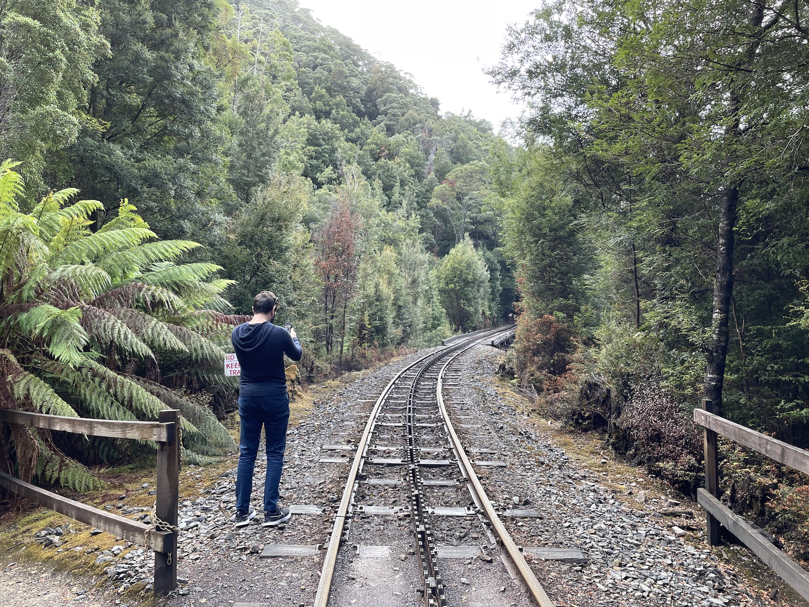
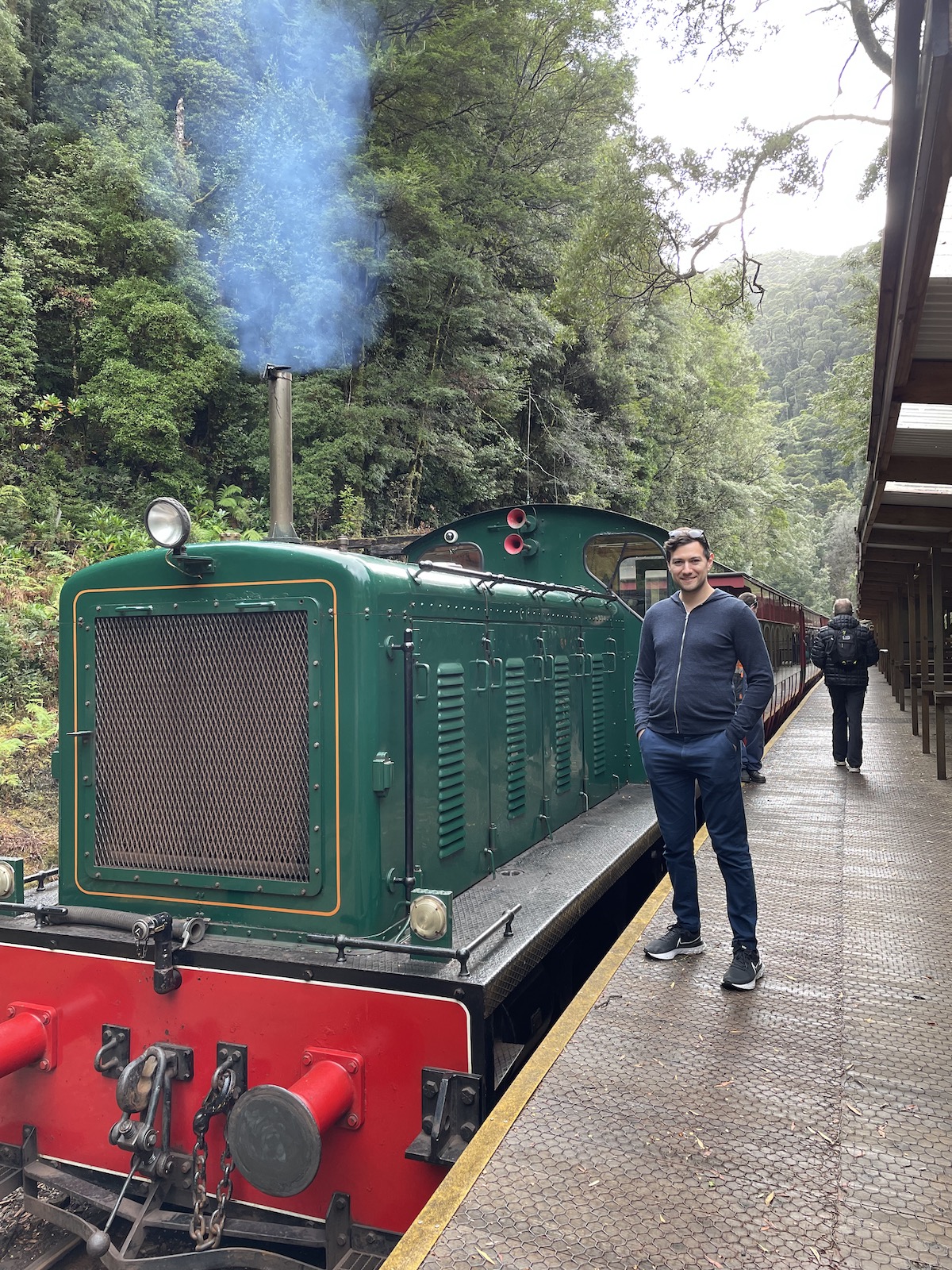
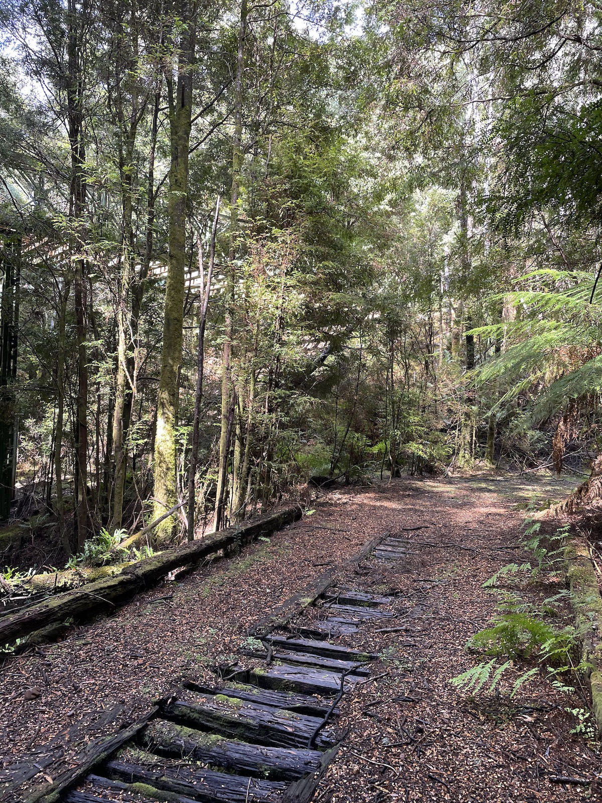
The views were beautiful, though, and we were served a course of small meals, with tea and coffee being complimentary. On the stops along the way, we had time to walk around and take photos, including doing a short rainforest walk. On the return trip, the engine of the train was switched to the opposite side, and passengers swapped sides, so we got a different view on the journey back. It was a great experience and worth the cost if you think it’s something you may like!
The small town of Strahan
We allowed ourselves two nights in Strahan – the first night was because we were travelling several hours from the north west and sightseeing on the way, so we needed a place to rest, with the next morning having booked the railway, and having time afterwards to explore Strahan. The town is really small and there aren’t that many eateries on the main strip. If you’re looking to stay in the area, you might have to book accomodation quite ahead of time. Some of the restaurants can be popular as well. There is a weekly show in the local theatre that has been running for many years, so depending on the day, the pub might be busy with people going for a bite after the show.
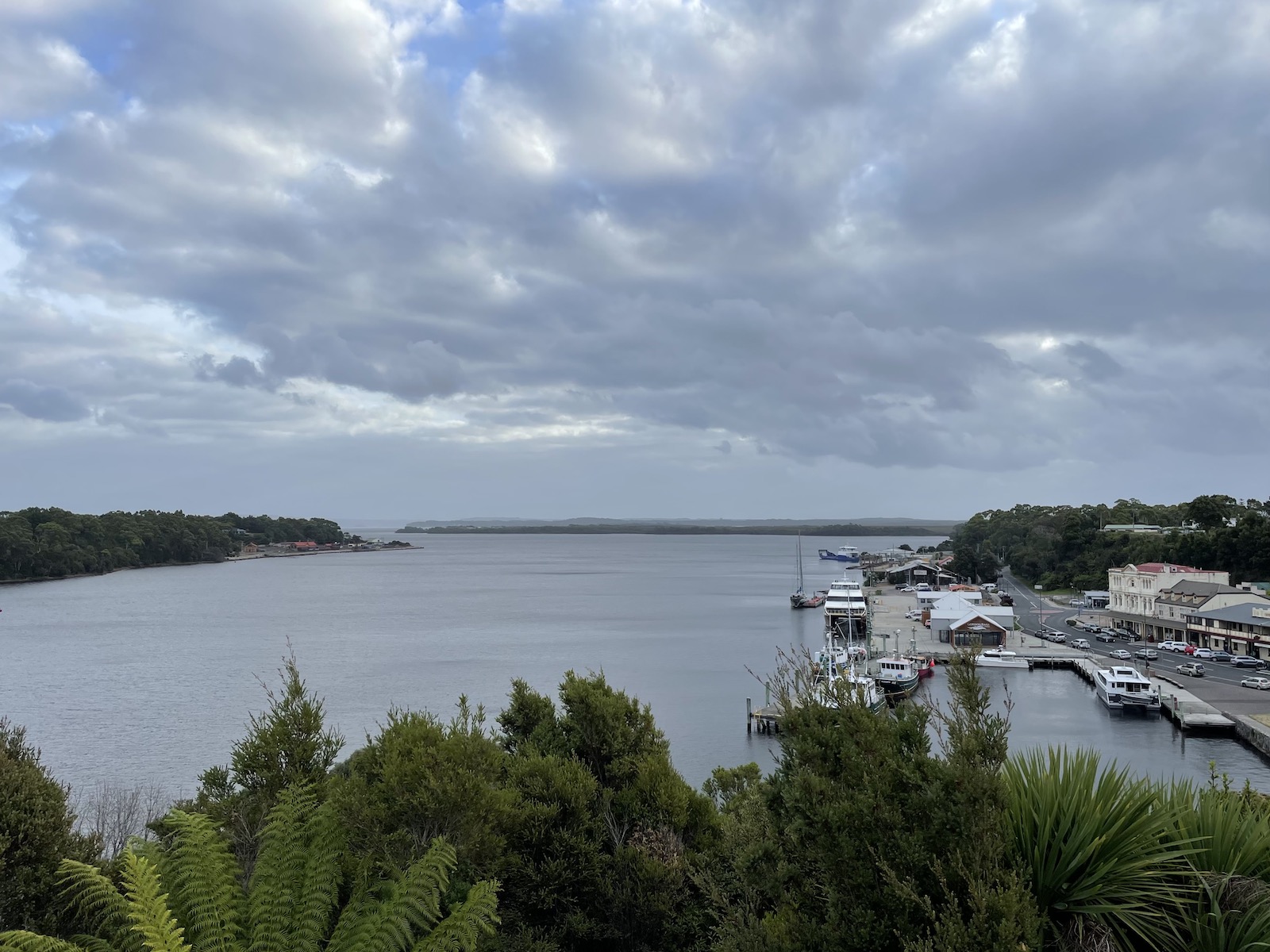
Strahan has a lovely rainforest walk that is about 40 minutes return. It’s worth doing if you’re there. You can also walk around the esplanade if you fancy a walk by the water – there’s a path that goes all around the small harbour. I’m not sure how accessible it is if you have a wheelchair or a pram, but there is definitely a path designated for pedestrian traffic.
Things to do near/outside Strahan
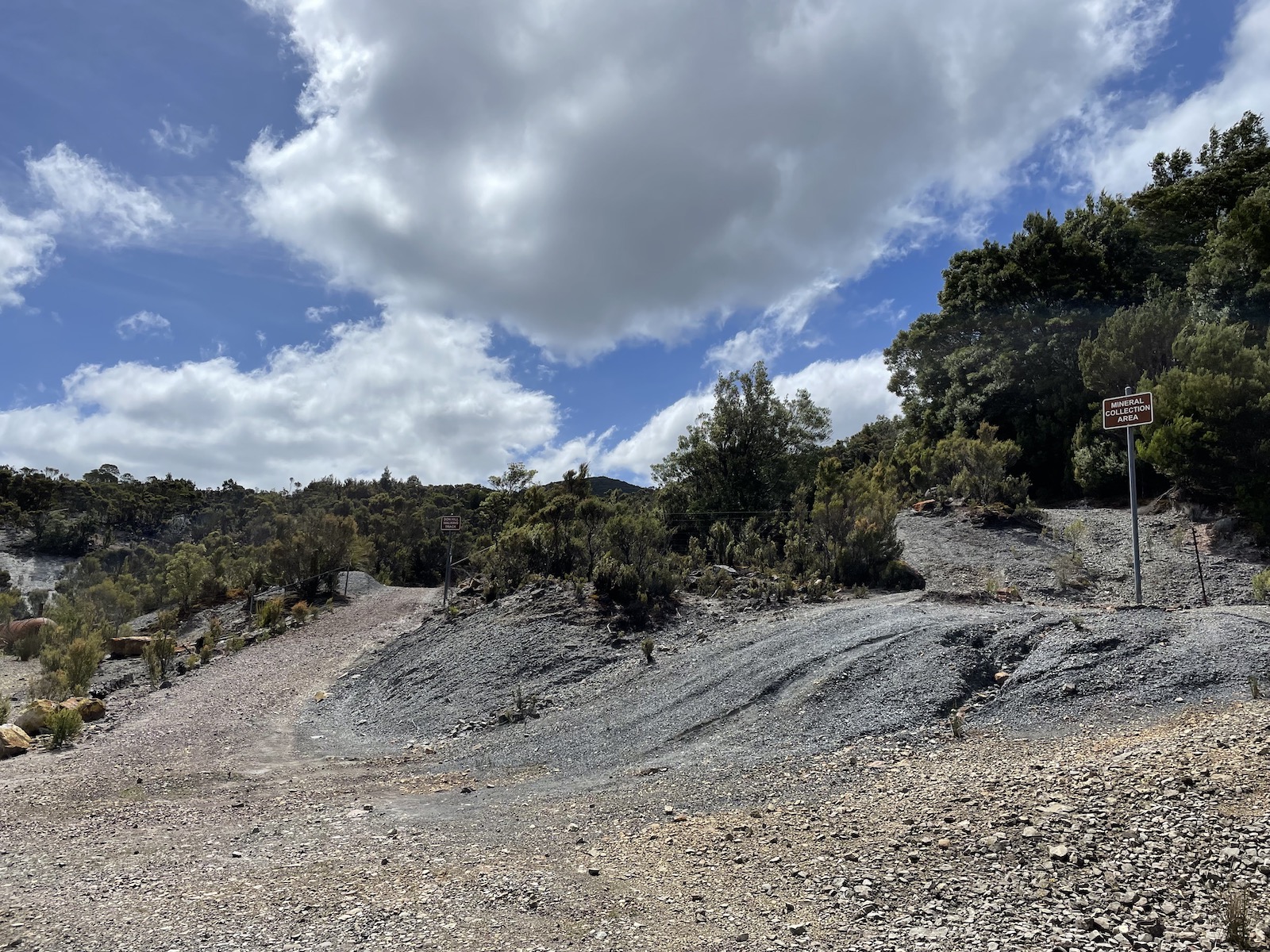
We explored a couple of things outside of Strahan – the Zeehan spray tunnel, Henty sand dunes, and Ocean Beach. The spray tunnel honestly creeped me out a bit, and people’s posts on Instagram made me think it was cooler than it actually was. It might just be me, though. The reviews online made it sound like it was worth checking out, too. Ocean Beach was alluring for a reason I’ll mention shortly. The sand dunes were incredible, especially because it was my first time seeing sand dunes.
Zeehan Spray Tunnel
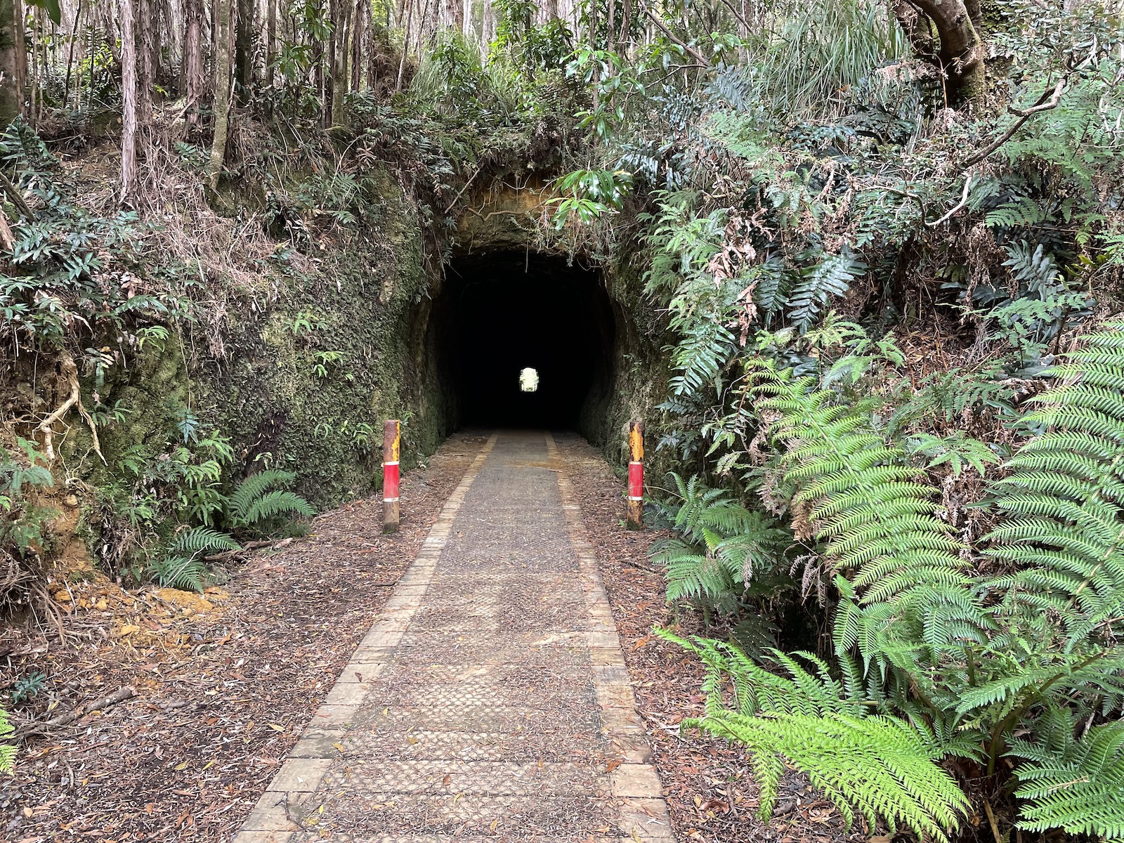
First of all, the spray tunnel. It was an old mining tunnel and is a bit over a hundred metres in length. You can sometimes see glow worms in the tunnel. The suggestion was to use a torch. I don’t know what I was expecting, but I haven’t seen glow worms before, and I think a part of me is still scared of the dark (I used a nightlight until I was 24). Nick suggested turning the torches off on our phones, when we were halfway through the tunnel, and I panicked and I didn’t want to. I was too scared to walk all the way to the end. 😂 The tunnel is also not very easy to navigate to – it’s up a one-way, winding road, or you can walk to it, but that walk seems to be mainly for mountain bikers. I probably wouldn’t recommend the tunnel, you’re not really missing anything if you skip it.
Ocean Beach
The next interesting thing out of the three I mentioned – Ocean Beach. It was just a detour for us. We didn’t plan this on our trip so we were just killing time. The road to the beach is a gravel one. We visited when it was nearly sunset. The beach doesn’t provide vastly amazing views, and there is a sign alerting you to wildlife in the area. But standing on the beach was really strange, especially when we paid attention to the waves and the tide. It looked so… low? The tide seemed so low and flat, almost like you could walk out into the ocean and walk on the water, or at least go a ways out before being fully immersed in it.
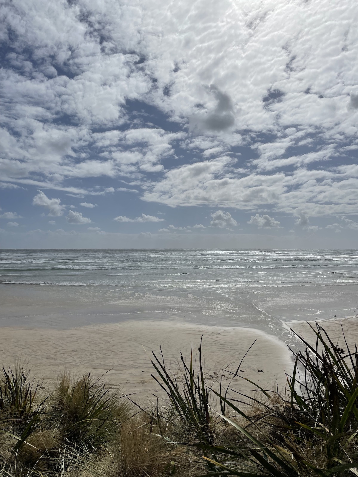
The waves were equally as mesmerising. They sort of didn’t stop, and before one wave really finished stretching out on the shore, another one would brush over it. After searching online for information about the beach, I found that it was used in the 1940s by local gliding and sailing club members, but the most interesting fact is that the beach gets its extreme weather due to there being no other landmass at its longitude until South America. 🤯 If you think about where Australia is on the world map, and imagine one of the lowest points where Tasmania is, and draw a horizontal line, the line wouldn’t even touch the bottom of Africa. Mind-blowing.
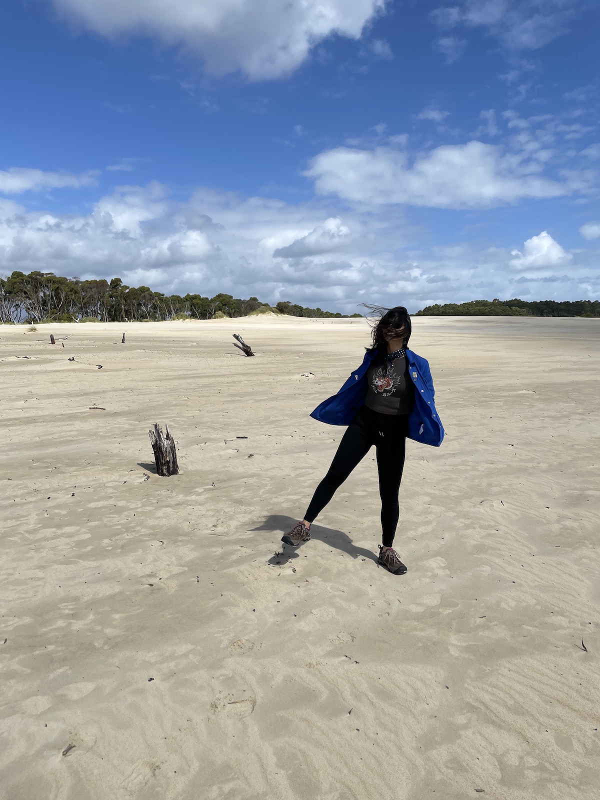
Henty Sand Dunes
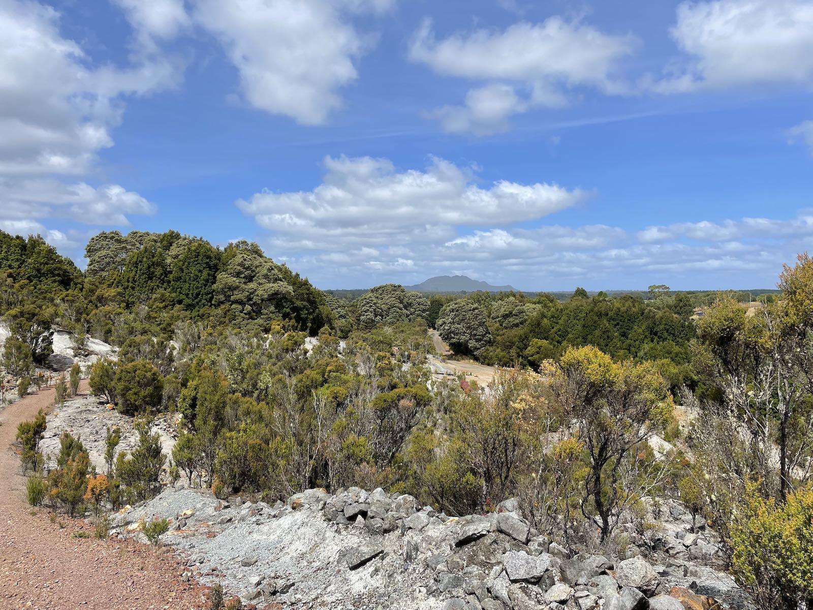
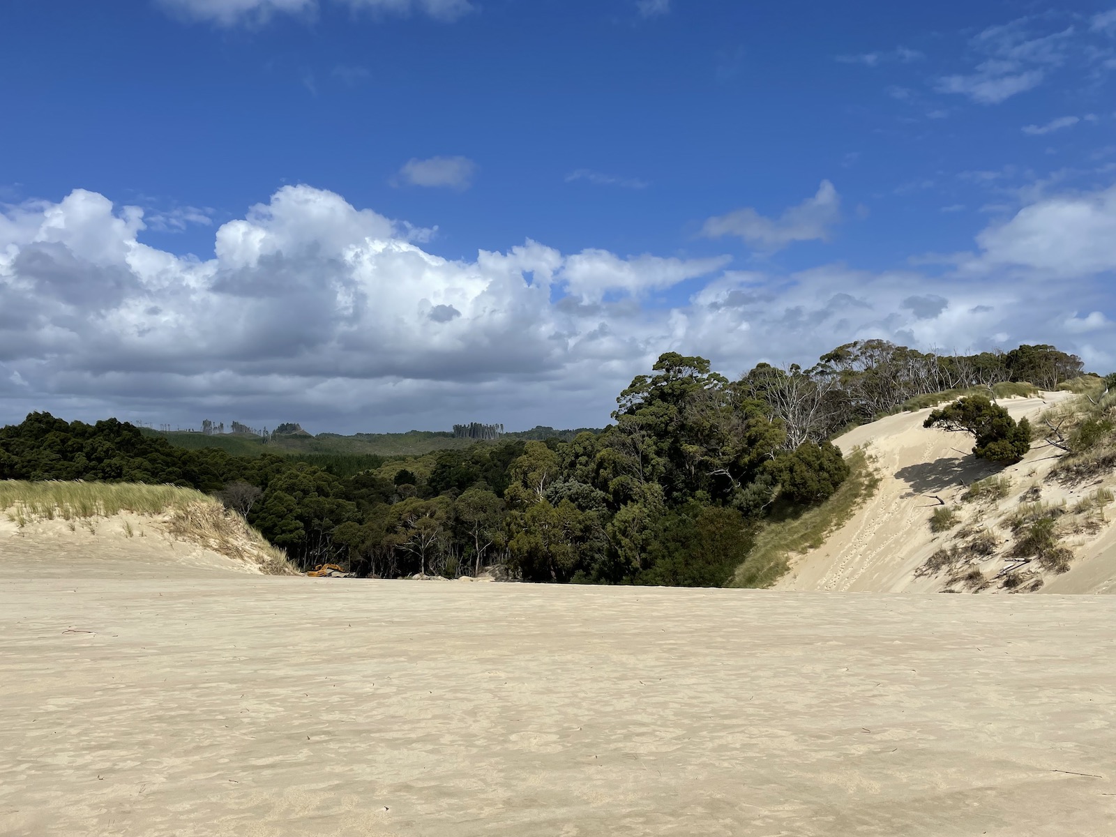
The Henty sand dunes are about 15 minutes north of Strahan, and can be accessed from the highway. You just have to keep an eye out for the sign that indicates the Henty dunes picnic area. As I mentioned, it was my first time seeing sand dunes so it was all quite exciting, especially with the heavy winds. You could almost see Ocean Beach from the top of the sand dunes. We did have to climb up the sand dunes, though, which you could tell some people had walked up, because of the dents in the sand presumably from people walking. You can hike to the beach from the top of the sand dune, but we were not prepared, and since it was going to take a few hours return, we decided not to do it. It was a huge effort going up the dunes, and it helped that I stepped in the spots Nick stepped, so that I wouldn’t slip down.
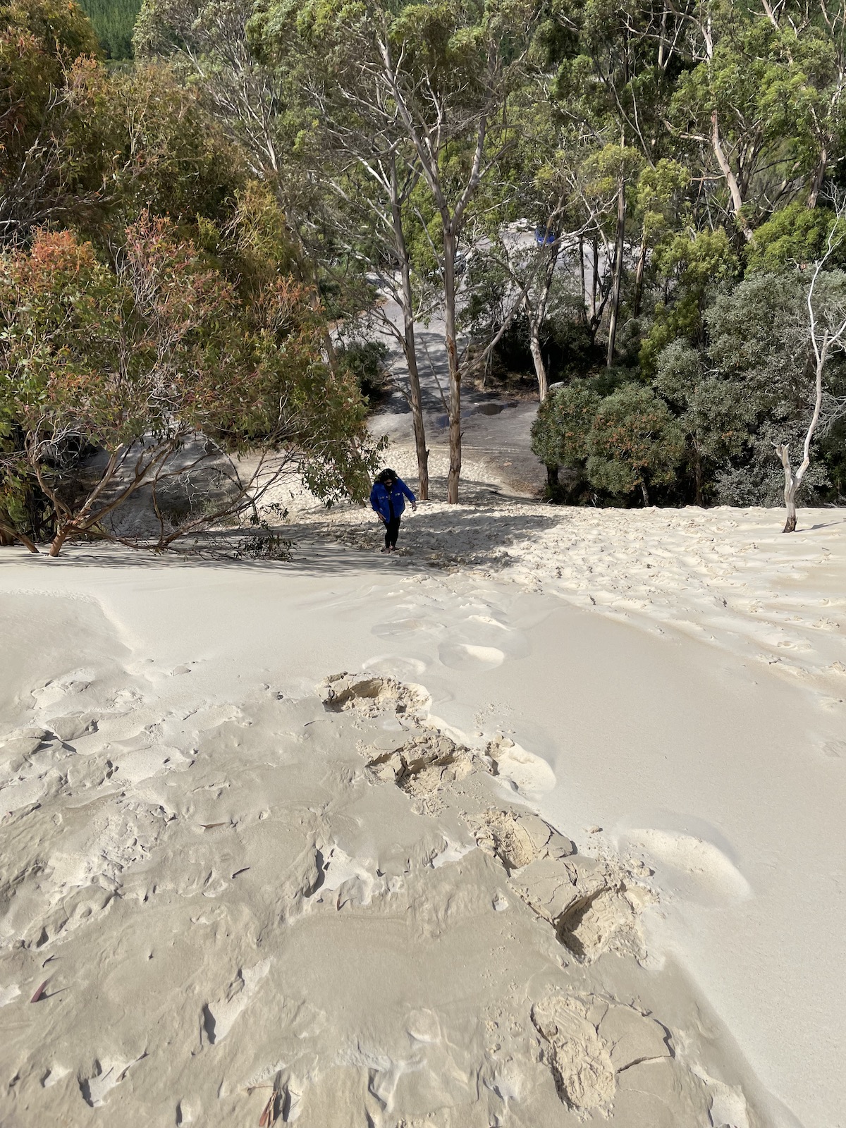
I remember reading a review on TripAdvisor where the person said, “I thought I was being smart by taking my shoes off so they wouldn’t get sand in them; it was a lot more difficult walking up the dunes barefoot”. They suggested actually leaving your shoes on and then dealing with emptying the sand out later. I thoroughly agree! Having our hiking shoes on made it so much easier.
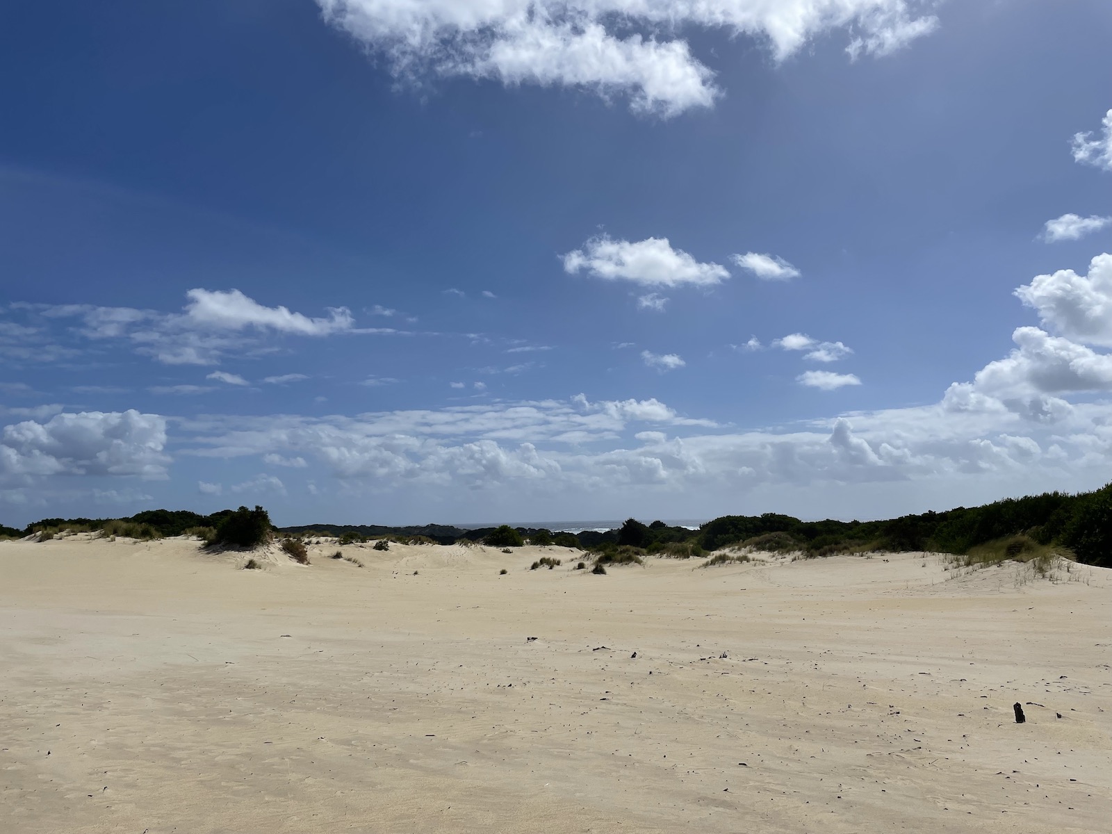
At the top we were met with flat sand that seemed to go on for ages. The wind did feel a bit chilly, so after walking around, we didn’t go too far before going back down the steep dunes and back to the car.
Driving between Strahan and Hobart
Queenstown and Spion Kopf Lookout
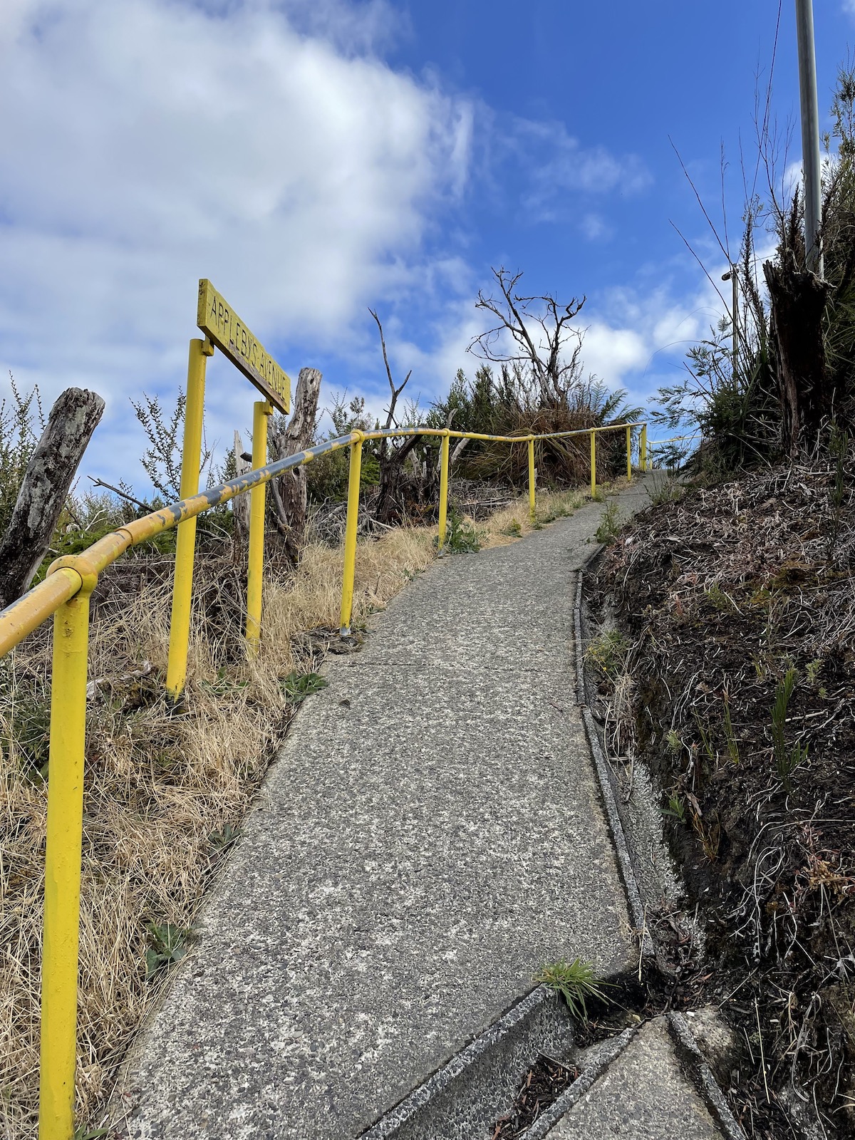
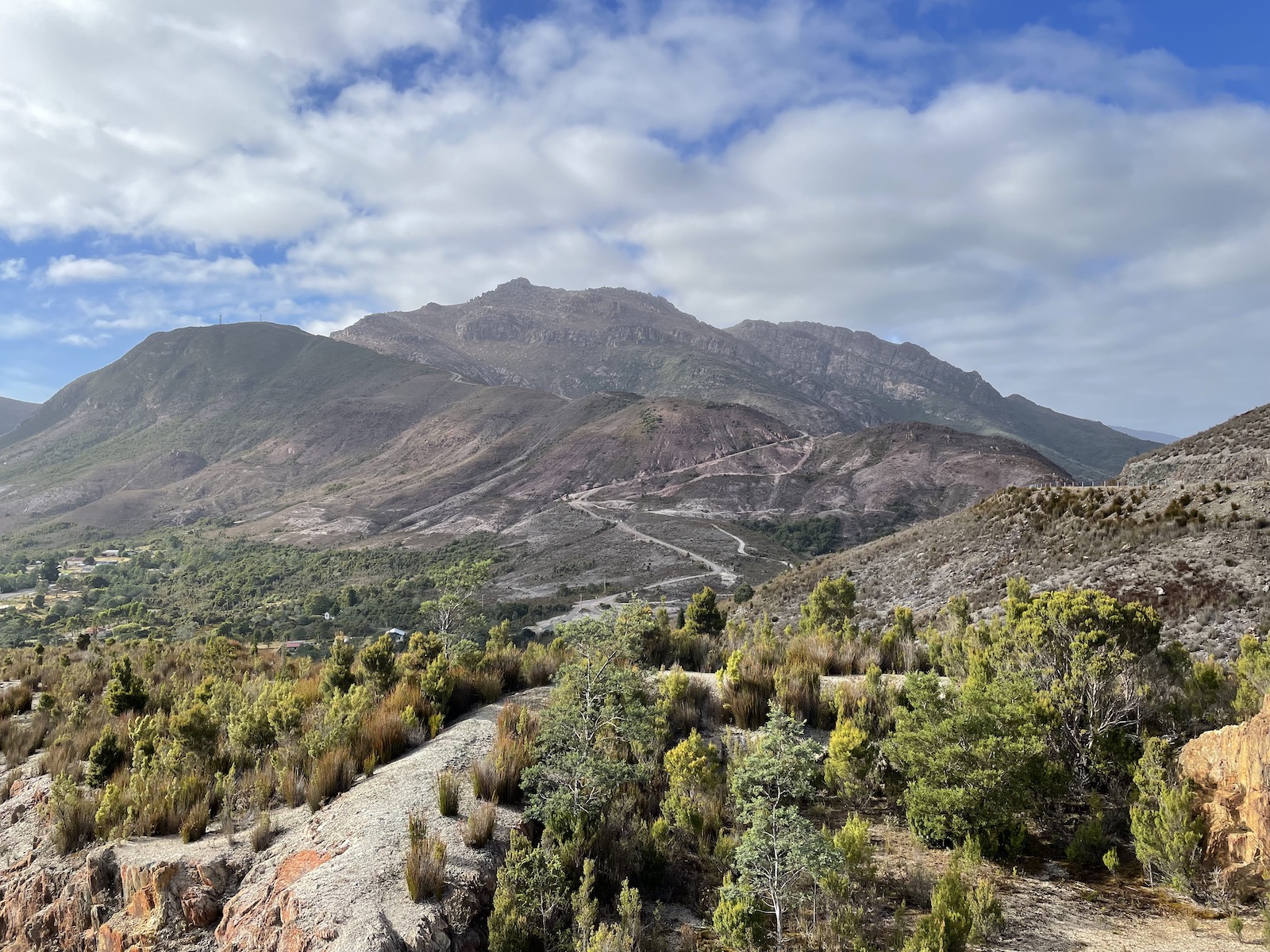
On the day we left Strahan for Hobart, we had a long drive ahead of us, and wanted to check out some sights along the way, so we left very early. Queenstown was about a 45 minute drive away, and that was where we had breakfast at the Tracks Cafe, which is in the station for the West Coast Wilderness Railway. (Strahan has its own Tracks Cafe but it seems a lot smaller.) We saw the steam locomotive ready to leave for the tour at 9:00am! I found out about a lookout in Queenstown just before we arrived, called Spion Kopf. It gives you a clear view of the whole town. The walk is really steep but quite short.

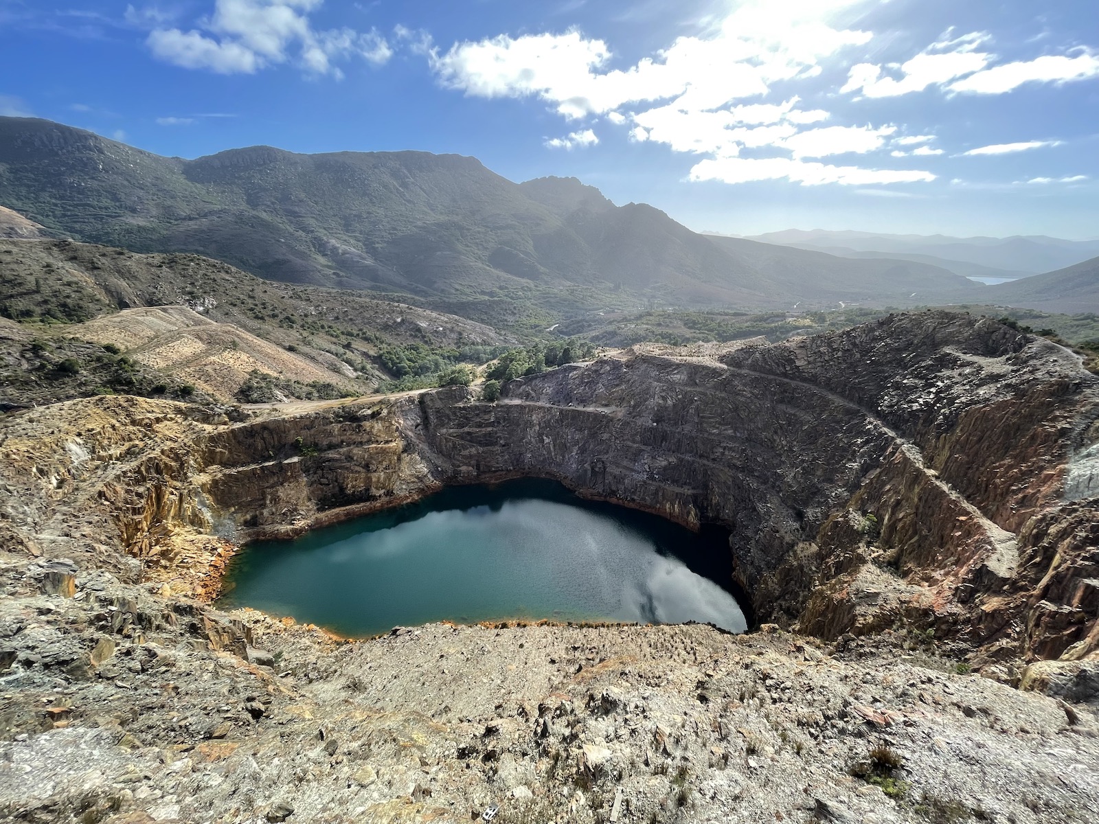
Iron Blow Lookout
Just outside of Queenstown are a couple of attractions worth checking out – the Iron Blow Lookout and the Horsetail Falls track. Both are opposite each other. The Iron Blow Lookout is on a cantilevered platform that gives you a view almost directly over an old open mine, which is now filling with water of the most gorgeous blue colour. It might not feel right if you’re afraid of heights, but it is safe. There is enough parking and you see some amazing views in general here.
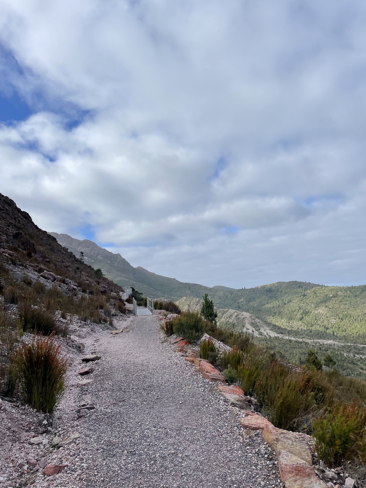
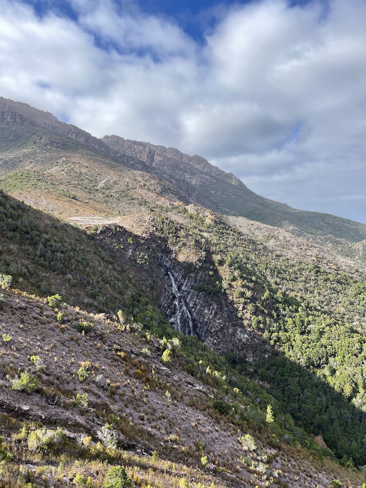
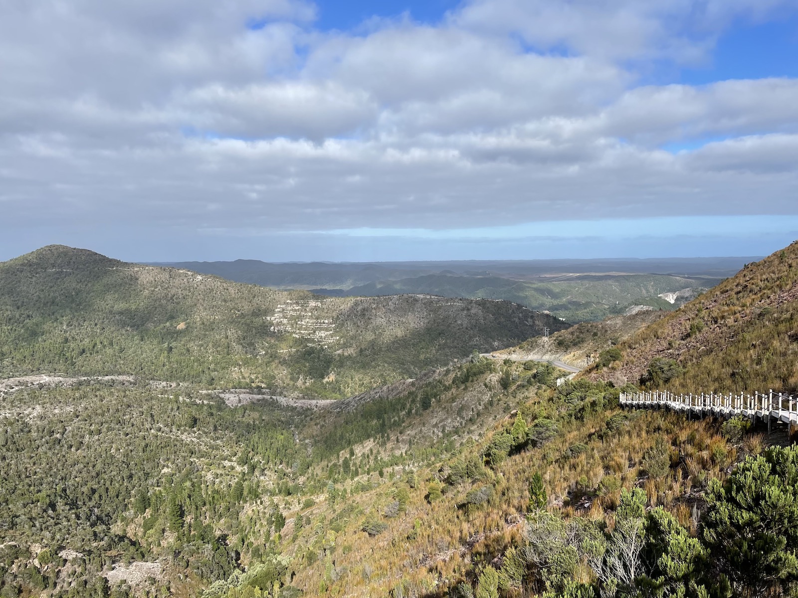
Horsetail Falls track
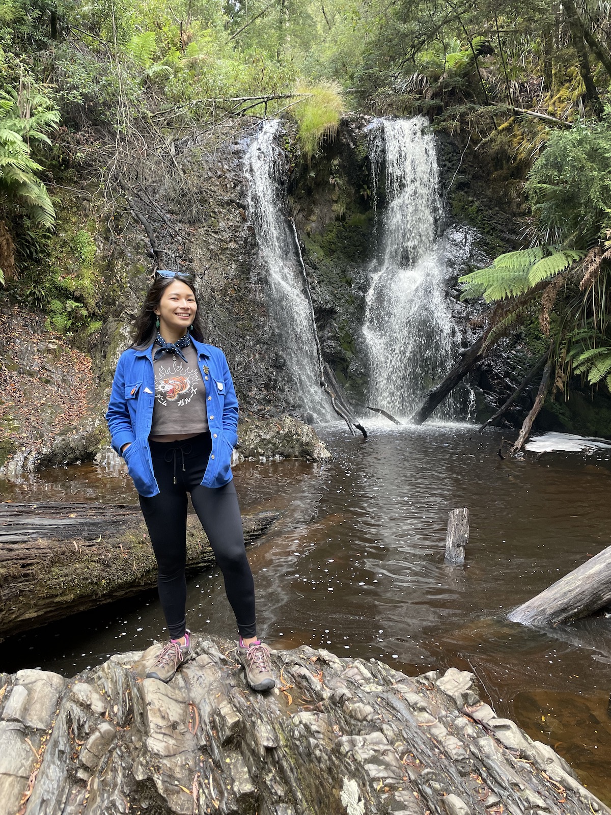
The Horsetail Falls track is just 1 kilometre return and will take around 30 minutes, probably less if you walk quickly. The falls themselves are not that impressive, they look like just a sliver in the mountain. But the fact that you are walking on a boardwalk that wraps around a mountain and you can see incredible views is the highlight. From here you might be able to see “Welcome to Queenstown” on a mountain in the distance, likely created with a vehicle rendering the green vegetation to dirt track, in the shape of the letters of the message.
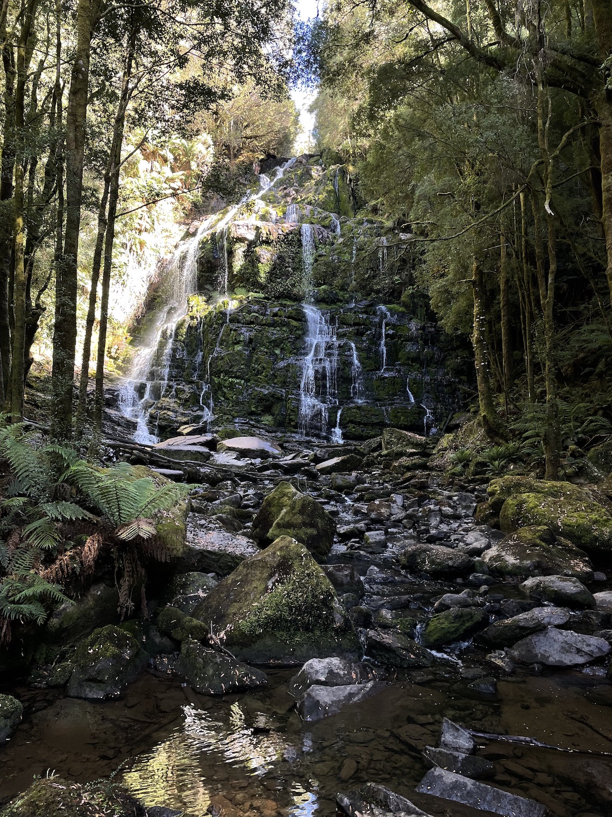
Nelson Falls track
We planned to stop at Mount Field National Park for lunch and a short walk before heading to Hobart for our flight. On the way, we stopped at Nelson Falls, which offers a 20-minute rainforest track. By this point I was just a teeny bit tired of seeing rainforests and waterfalls. There are actually a lot of options for hikes and trails to see if you are doing the long drive between Strahan and Hobart – but we didn’t do every single one, obviously.
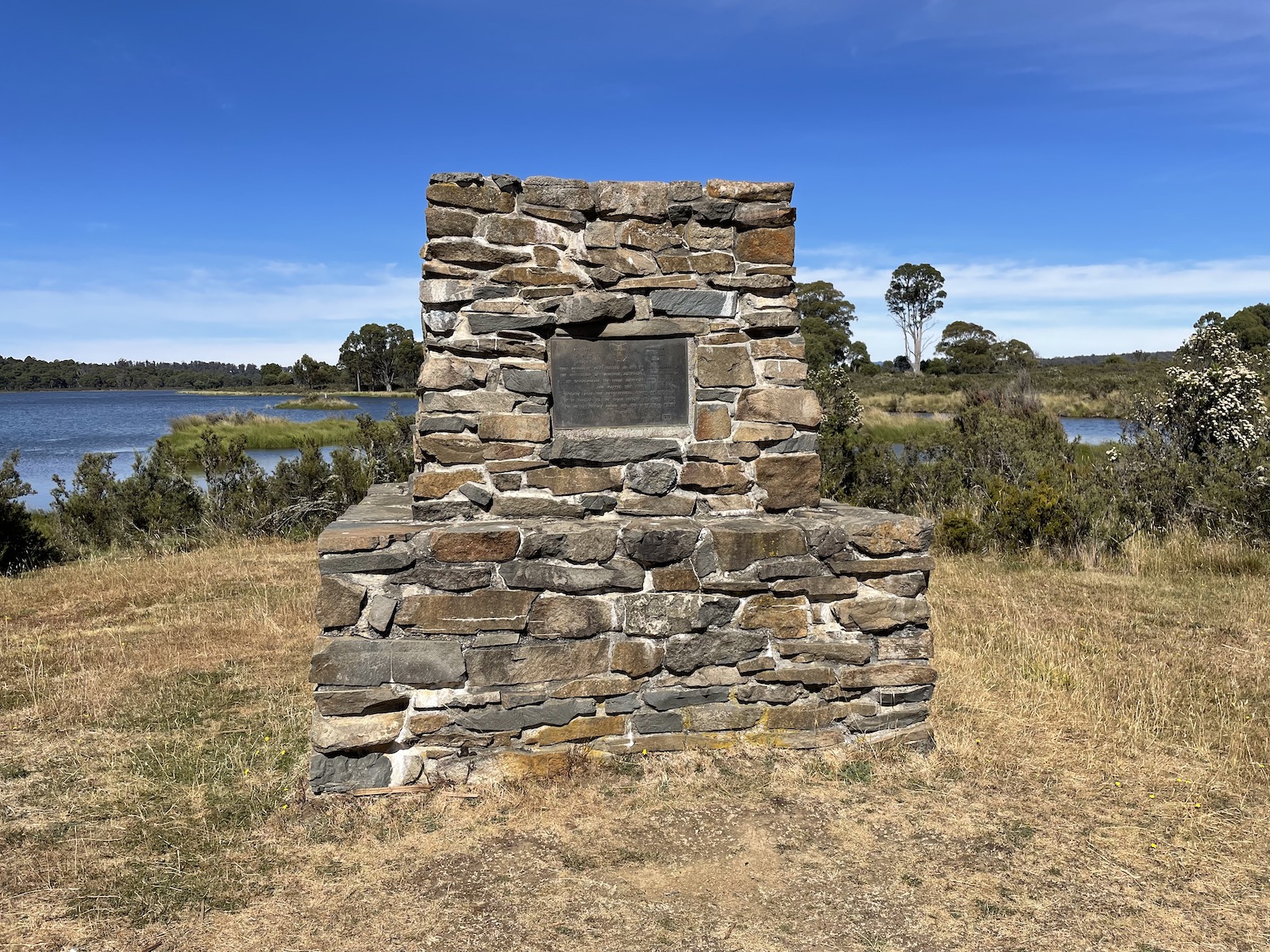
The Geographical Centre of Tasmania
We also came across the literal geographical centre of Tasmania. Nothing special – it’s just a small monument on some swampland near a bridge. Another guy, travelling alone, pulled up in his car at the same time we did. He seemed to be a little more invested in it, as he took quite a few photos and was enjoying what was around. (Which was not much.) It’s the kind of monument you’d look at just for fun.
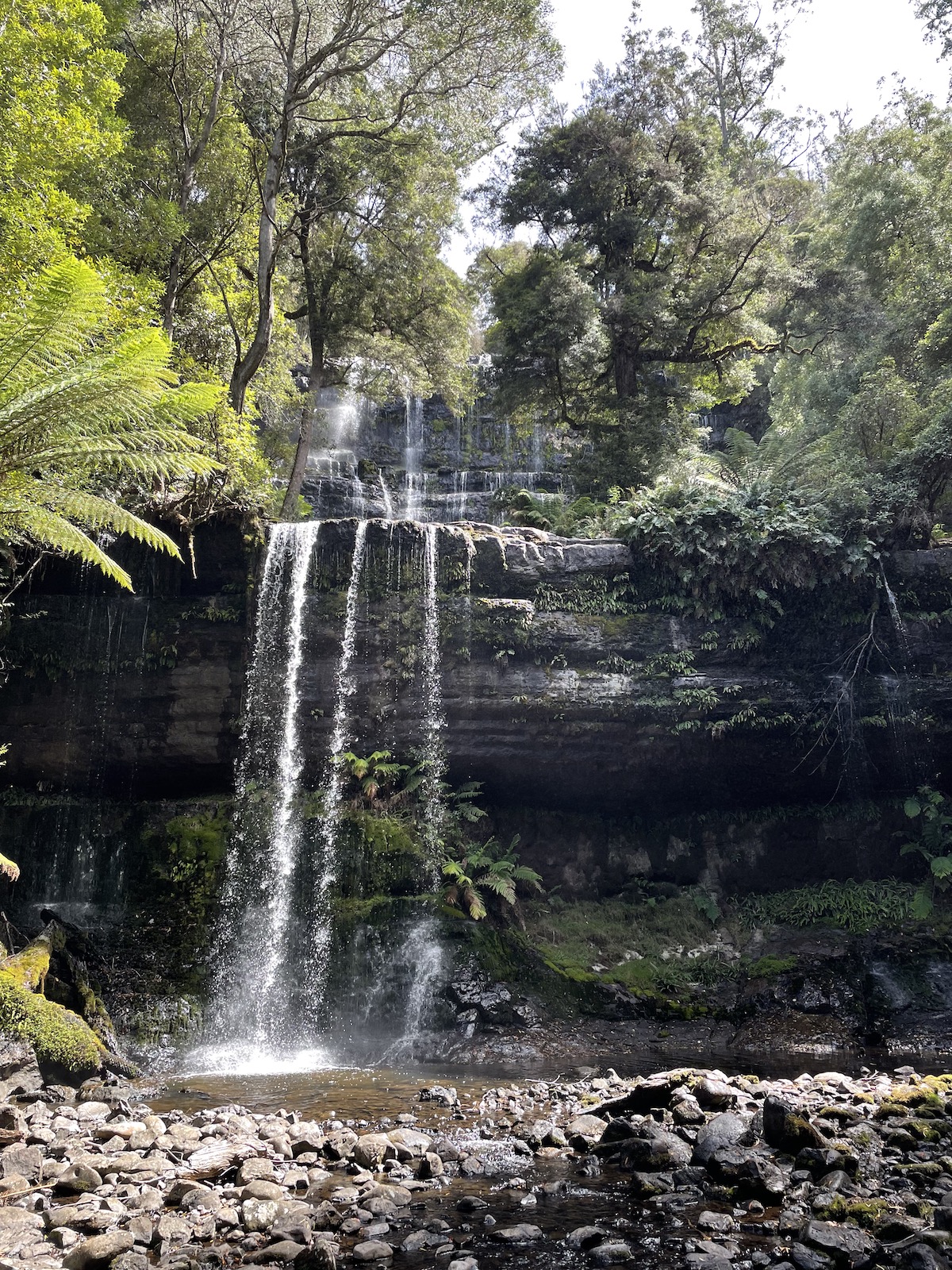
Russell Falls, Mount Field National Park
At Mount Field National Park we did the short Russell Falls track (you have the option of a Grade 1 accessible path, or a slightly rougher one through the bush), and because the falls were not too far from the Horseshoe Falls, we continued on to that point and then turned around and went back. If we had more time I would love to visit again. There are several other tracks here that look like they are worth checking out.
That concludes our adventures in Tasmania. 😌 We saw some incredible sights and had a great time. It was probably one of our most tiring trips – it felt really go-go-go, and we didn’t have a great deal of time for relaxation. But it was a trip I thoroughly enjoyed. I really like Tasmania and would love to go back again. 🤩