Tasmania north east to north west: Mount Paris Dam, The Nut, and The Big Tree
If you haven’t read about the first part of our week-long trip to Tasmania recently, feel free to read that first. 😊 After spending some time on the east coast, we travelled by car to the north west coast, stopping at Launceston on the way. We didn’t go to Cradle Mountain this time or even spend much time in Launceston because we did that a couple of years back. This post is about some of the sights we saw between the north east and north west coast. We stayed for one night in Launceston and then took a scenic drive through the towns on the north-west coast and visited The Nut at Stanley, before staying the night at cottage on a lovely farm in Black River.
So, where I left off in the last post was leaving Binalong Bay on the east coast. From there, we had a couple of short walks planned on our way to Launceston. One of them was St Columba Falls, which was only about an hour’s drive away. The short rainforest walk only took about twenty minutes, and we got lucky when we arrived because there were only two other vehicles parked and one of them left, but when we got back to our car after the walk, at least a dozen people arrived. 😆

The walk was in a somewhat secluded place after driving through a lot of farmland. It was a return track, and at the end you were greeted with this amazing waterfall that you can see from a viewing platform. The waterfall has never known to run dry.


We stopped at another very short rainforest circuit about twenty minutes away, but there wasn’t too much to see. It had lots of signposts and was aimed at younger children because the signposts told a little story personifying the trees while sharing the history of the land and encouraging preserving the rainforest.

Mount Paris Dam
After driving a little while longer, we arrived at a small town called Weldborough, checking our internet connection on our phones and determining which direction would be most interesting to head to Launceston. Nick spotted a brown recreational sign reading “Mt Paris Dam”. I am fascinated with those brown recreational signs when I’m on the road. Since they’re universal, and indicate some interesting landmarks, sometimes I find it hard to say no to an enticing sign. Prior to our trip, I had looked into some interesting things to do on the road, and there were definitely some spots in Tasmania where hydro-electric dams were set up (we saw them later in our trip), which I told Nick he might be interested in. I was a little reluctant to check out this Mount Paris Dam, but we looked it up on the internet and found an informative blog post that made it seem worth exploring.
The blog post said that Mount Paris Dam rewards the explorer rather than the effort. That really spoke to me and my tendency to take risks for the sake of exploration. I almost said “urban exploration”, but frankly, I’m not into going into sewers and other strange nonsense; I simply love exploring the intricacies of preserved nature and its history. So we drove along a six-kilometre gravel road to get to Mount Paris Dam. The hire car was definitely filthy after that. 😅


The dam was honestly one of my favourite things on our trip, not only because it was unexpected, but because it was such a unique sight. It is a very small and abandoned dam, with the Cascade River running through it. It was built in 1936 as the “Morning Star Dam” for the purpose of tin mining, for the Mount Paris Tin Mine nearby. The dam operated until the closure of the mine in 1961, but changed owners a couple of times along the way. It was not until 1985 that the Rivers and Waters Supply Commission decided to blast a hole in the bottom of the dam to let the Cascade River run naturally through.


Nature is reclaiming the area as the river continues to flow and vegetation grows in and around the dam. It makes for some incredible photos, though. I found it so fascinating. We entered the dam from the flowing river side, and walked up the path around the back side of it, which was a hundred or so metres before you had to sort of climb over the top of the dam, where part of its construction is embedded in the ground.


Although it is on a gravel road and you have to take it easy if you’re not in a truck or a four-wheel-drive, I think Mount Paris Dam is definitely worth the effort if you find yourself somewhat close to Launceston and have some time to spare. If the photos and the description doesn’t spark your curiosity at all, then I think it’s fair to say you might not be interested, but if they do, you might really like what you see. 💚
We stayed in Launceston for just one night, but walked around the town a little bit. The furnished cottage stayed in had provided us with a breakfast basket. It was full of breakfast goodies including muesli, milk, fruit, and eggs. Since we planned to leave Launceston early – at around 7:30am – the following morning, we decided to either eat some of the breakfast or bring it with us for the ride and eat it the next day. It was somewhat unplanned, but I discovered a raspberry farm cafe on the route we were taking, that opened at 7:30 and would be a tasty option for breakfast. This was going to be a somewhat long day for us because we were driving to the north west, and the drive was going to be about two-and-a-half hours. We also wanted to leave sufficient time to explore the north west coast.

We had no idea how to transport the eggs. We spent maybe fifteen minutes wondering if we should put them in my coffee cup, put them in a bag somewhere, in the centre console of the car… but most options made me very concerned that the eggs would crack, go all other the other eggs, and we’d be absolutely fucked. 😂 We ended up putting them carefully in the netted pocket behind the driver’s seat, semi-wrapped in our beach towel that we no longer planned to use on the trip. They survived the trip. 👏🏻
“Cradle to Coast”

Rain started to pick up on our travels. It wasn’t too bad to begin with. After the raspberry farm cafe, we stopped at a dairy and shared a toast and watched cheese being made through the giant windows; we also stopped at a chocolatier but weren’t in the mood for snacks or purchasing chocolate. Then we went to Turners Berry Patch, a decent sized berry patch in Turners Beach, where you could pay $10 to pick your own berries. We brought an umbrella with us since it continued to rain, but it wasn’t enough to completely interrupt our berry-picking.


If you are travelling between Cradle Mountain and the north-west coast, there are a lot of spots to stop by and taste different foods like the berries, cheese, and chocolate, and places to have beer or wine. I believe it’s called “Cradle to Coast” tasting trail, and is useful for breaking up a long drive and having an opportunity to taste the local Tasmanian produce.


We stopped in Burnie for lunch, after driving through Ulverstone and Penguin. Penguin has a brewery (and you will find quite a few around the state!), but we weren’t that interested in stopping there. It makes for a pleasant scenic drive, but I don’t suppose too many people think about going to the north-west – when we reached our accomodation and spoke to the Airbnb host’s husband, he said that usually people visit the area last, after making their way to Hobart and Launceston. 😆 I guess it’s easy for people to visit major cities first, yeah. It was raining a lot when we were driving through the towns, and sort of stopped when we reached our accommodation.
Mrs M’s Cottage


We stayed at Mrs M’s Cottage on the beautiful Mayura Farm and the family dog, Maggie, welcomed us and also didn’t want to leave us! She came into the cottage and sat around wanting to be petted more. When we were heading back out to go to Stanley (twenty minutes drive away), she was waiting at the door. 🐶


The main attraction we wanted to see in Stanley is The Nut. The Nut is a large, flat, rock mountain, and is actually what’s left of the core of a volcano. The top of it is accessible by a pretty rudimentary chairlift (for a fee), or you can walk up the very steep hill, which I think only takes about fifteen to twenty minutes, and zig-zags for about 430 metres. The chairlift is only open at certain times, and won’t run when it’s very windy or when the weather is extremely poor. Thankfully, while we were outside and exploring The Nut, the rain kept away. It only returned once we got back to the bottom and got back in the car.
The Nut at Stanley


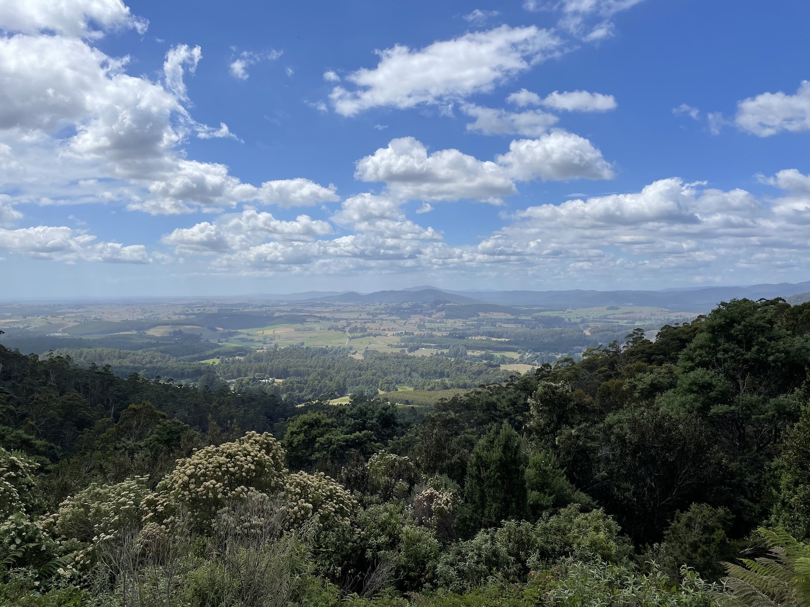
The vegetation at the top of The Nut is a mixture of pale long yellow grass/shrub, and patches of forest, as well as open lookouts where you can see the ocean and the town of Stanley. Walking around The Nut is relatively easy and the ground is flat, although may not be completely wheelchair accessible. There are wide paths, but some sort of rough, if I recall correctly, there were probably some stone steps towards the lookouts. It’s a two kilometre circuit and we walked very quickly so we wouldn’t miss the last chairlift ride, so we completed it in about 30 minutes. It would probably take 40 minutes on average, although the signpost says an hour, so I would say that’s accurate if you really take your time.


There is a self-guided heritage walk you can do in the town of Stanley, but we were short on time and the weather got in the way a bit as well.
The next morning we enjoyed a little sleep-in, and Nick made scrambled eggs in the cottage, with both the eggs we brought with us and the eggs that were supplied in the cottage. They actually came from the chickens on the farm! We didn’t have to leave that early because we would be in Strahan on the west coast that evening, and the following evening as well. The only thing we had booked was the West Coast Wilderness Railway early the following morning.


Dip Falls and The Big Tree
Strahan was quite a long drive so we did a lot to break up the three-hour trip. I’ll leave this post with two sights that were near each other, and about 45 minutes from the farm: Dip Falls and The Big Tree. These two sights were in the town of Mawbanna. Dip Falls had an incredible set of stairs that went deep down to the bottom of a waterfall. You could also see the waterfall from a higher vantage point across a bridge from the carpark.


A short drive away was The Big Tree, a huge, old eucalypt tree that is one of the last trees of that species and size in Tasmania. It won’t be all that impressive to folks from the United States who have real forests, but it’s a big tree for us! It might not be a lot to see, but worth it if you are passing by. You can see a couple of other big trees in the same area, but the main one has a small boardwalk around it.

My next blog post for this trip will cover the sights we saw on the west coast, the West Coast Wilderness Railway, and some of the things we came across on our long drive back to Hobart to return home. ☺️
Comments on this post
Jane
?? This is one of my dream places ever since I learned of its existence 😍
Stanley looks like a mermaid town 🤤
Also love how you wore a skirt to a hike 🤭
Georgie
Haha it’s a pair of shorts!! 🥲 But yeah, why not be fashionable and comfortable when I hike haha. I’m still finding ways to do it “well”, but for longer hikes I am definitely more inclined to go for activewear haha.